After some sunny days to start the week, clouds build in Tuesday night ahead of a cold front coming through.
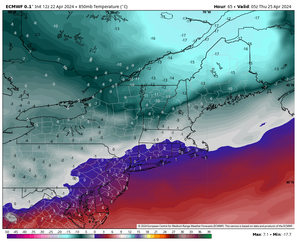
We’ll likely see mostly rain with this but there will be some transition to snow on the back end as a push of cold air does slam through with it. Image is from midnight Thursday morning. Many summits are in the teens or single digits.
Total rain should be .25-.50″ with a couple inches of snow possible to round it out as cold air rushes in.
The cold doesn’t stay that deep, for that long, but it does stay cool into Friday and the early weekend. We’ll start to see things warm up into Sunday and early next week.
Also, we’re officially in a weak El Niño at the moment as the transition continues…