
The week ahead isn’t nearly as exciting as last week, despite the global weather pattern having us in a fairly decent early spring position. Latest information from the Climate Prediction Center has us squarely in a moderate El Niño, which means fun is still there to be had over the next couple of weeks.
But this week, I think we see more clouds than sun, the NE winds will play some interesting games with temperatures, and likely create a fair amount of inversions.
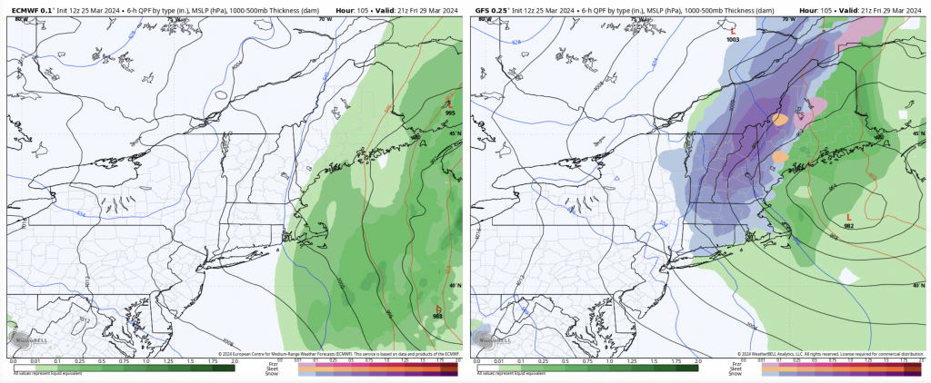
It still looks like we may see some substantial rain Thursday, especially into NH/ME, though looking less into MA/VT/NY. There’s quite a bit of discrepancy on the evolution of the front/low pressure interaction, especially toward Friday when the GFS wants to spawn a coastal in the Gulf of Maine, but the Euro isn’t quite on board with the same positioning. For what it’s worth, the Canadian leans a bit more GFS but it’s not as excited as the GFS in terms of banding (blog image).
That’s about the only true excitement of the week ahead. Given we are in a moderate El Niño state and slowly weakening, coastal storms are 100% on the table. The NAO also drops into 3/31, so perhaps the GFS is onto something.
The weekend looks quiet and cooler, with the next potential system arriving 4/3, and right now, it’s mostly white.