We’re back to a more winter-like pattern this week, with several opportunities of snow and an overall cooler pattern.
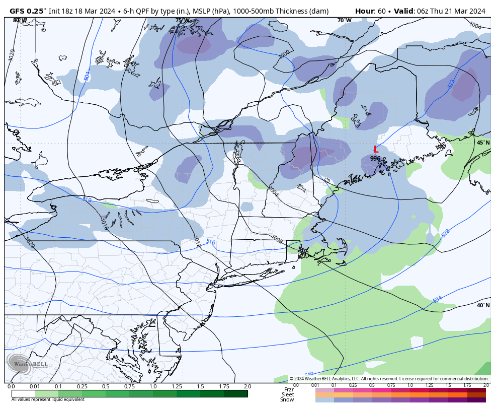
Upslope snows will be continuous through the favored slopes through most of the week. We’ll have a system come through on Wednesday which may spawn a triple-point low and create some localized stronger banding. Depending on when that low forms, it could be significant.
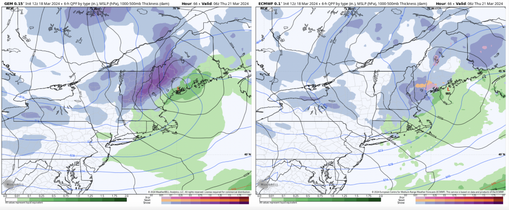
I’ve posted the three models’ depictions of the scenario.
We’ll have to keep close eyes on this progression. Behind the storm system wind will pick up, along with the resurgence of upslope snows.
Cold sets in again behind this system, and the timing and strength of it will determine if we see another storm system form for the weekend. This could provide a moderate to significant snowfall from the Catskills into northern Maine, depending on how much time the coastal low has to form, and if it can phase with the northern energy.
The GFS has been the most robust with the coastal low solution, but the others are coming along a bit more with the idea of some sort of system. Could be the most exciting winter week since January…
Behind the storm system we’ll have another cool down, but things do look to warm up for the final few days of the month.