This is our first of two warmer weeks with strong cold fronts coming through to crash down temperatures.
Tuesday will be quite warm across the board, with the cold front heading through the Great Lakes Wednesday morning and off the east coast by Thursday morning.
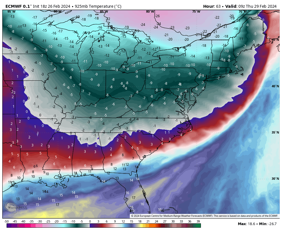
Temperatures will be in the 40’s & 50’s in most areas before the front comes through, and back down to the single digits and teens after. The 925mb temperature pattern shows this pretty well for Thursday morning with the most dramatic temperature gradient in northern New England (image).
Wind will also be a huge factor Wednesday into the Thursday in the Northeast, first with gusty SSW winds and then WNW winds.
The cold may slightly outpace the precipitation, therefore we’ll have some quick snow before the system departs. Prior to that, rainfall should average .25-.50″ west and south of the White Mountains, and .50-.75″ for the White mountains east.
However, the air mass moderates quickly, and we’re back to somewhat mild temperatures Friday. A weak low pressure system offshore will keep clouds in on Saturday, therefore temperatures will be lower than initially anticipated, but we’ll warm up on Sunday once clouds depart to widespread 40’s and 50’s.