We’re into December, which means we’re officially in meteorological winter. The new MEI value should be out by early next week to see where we are atmospherically, and the ONI is usually out 6-8 days after the beginning of the month, but we know that’s been running high. The last time we saw ONI’s around this level was 2015-2016, and I don’t think we’re following in those footsteps.
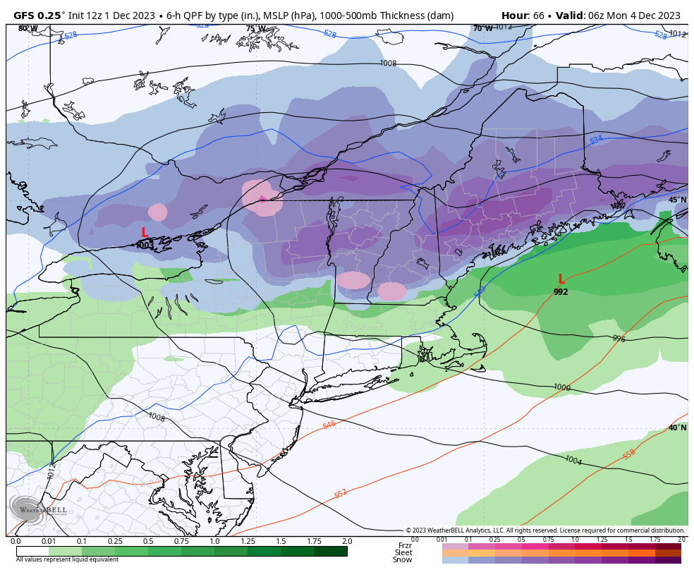
We also have a potentially impactful storm coming late Sunday into Monday, which I will do a video blog on tomorrow if it still looks as intense as it does today.
Into the long term…after some fairly consistent cold rounds, we’re going to enter into a bit of a lull from around December 7-17. The images shown below somewhat overlap those dates so I’ll provide a bit of some explanation.
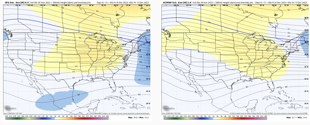
We see for Days 7-14 that the trough is moving out of the East with a ridge building over the central part of the country. However, looking at the ensembles, I don’t see an overarching, blow torch pattern, but rather less cold intrusions, or perhaps less intense cold for the East — it may be more on the warm end for the Great Lakes. We’ve been talking about a lack of consistency until mid-month December, and I still think we’re on that track.
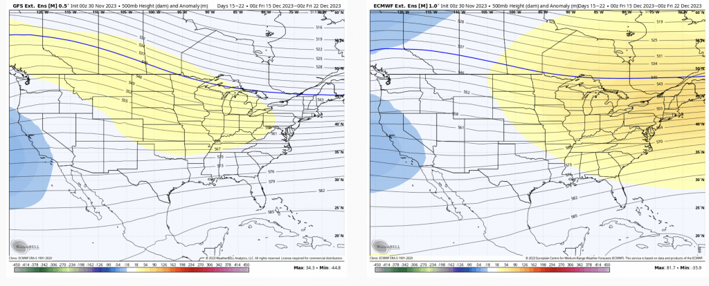
The GFS has been seeing the cold in the long range pattern better than the Euro recently, so I’m hedging a bit more toward GFS for Days 14-21 which shows the ridge more centered over the central U.S. and not the east. This is indicative of a very active pattern while we’re inconsistent in air masses, which means we could see storms of all varieties.
As we’ve been hinting at for a couple months now, things really start to get interesting in the holiday weeks.
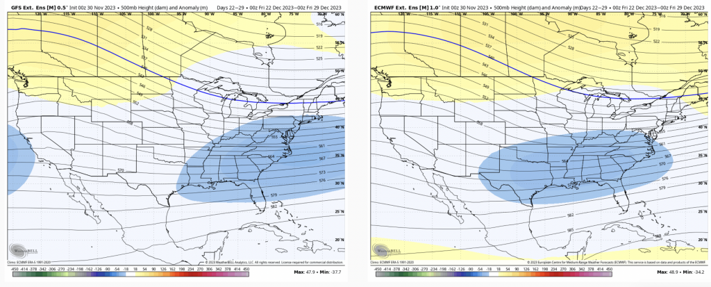
The cold should start intruding more along with an active pattern heading into Christmas week as the eastern trough redevelops. All signs beyond this still point to that the pattern sticks around for several weeks.