The week ahead will have some volatility to it; we don’t stay in the same place for very long until we get to the weekend.
Temperatures rise tonight as the first of two systems this week arrives from the Great Lakes (after bringing some heavier rain there). The band with the warm front is fairly weak, only bringing .10-.15″ across the region. We may have a secondary round of scattered showers as the cold front comes through Tuesday afternoon.
Wind is elevated out of the SW Tuesday.
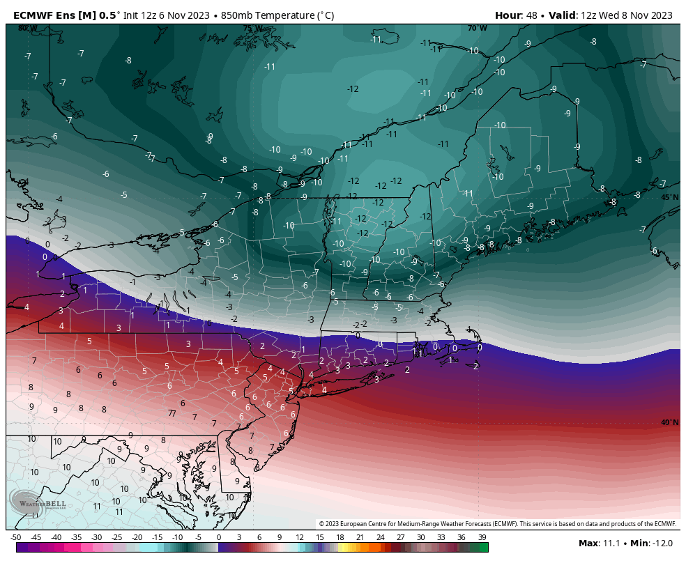
We’ll have a sharp drop in temperatures Tuesday night into Wednesday, with many summits getting into the teens from the Catskills north and some hefty wind out of the northwest. The orientation of the cold airmass doesn’t allow for the cold to stretch into the Great Lakes or the greater Mid-Atlantic. This cold blast will be the strongest we have seen across the region, despite it being so quick (image from the Euro Ensemble of 850mb temperatures at 7am Wednesday).
The next system moves into the Great Lakes with light rain/snow showers Wednesday.
Temperatures move back up Wednesday night into Thursday in the Northeast ahead of the incoming system, which will bring light rain/snow/mixed precipitation across the region Thursday.
Cold slowly moves back in Friday, and a bit more deeply on Saturday. We may see upslope snow showers in the favored slopes of the Adirondacks/Greens through the weekend. There’s been some discrepancy on how deep and long the cold hangs through the weekend, but the general consensus is that we’ll at least have it through Sunday.