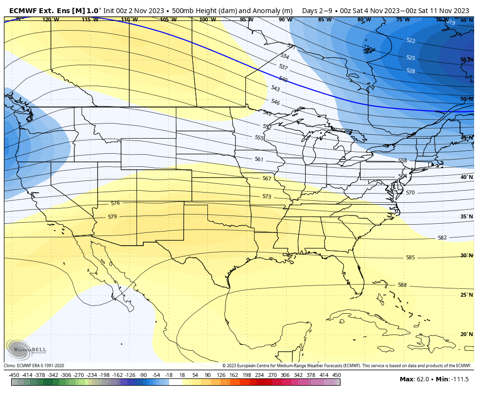
We’ve ventured through our first block of cold, and for now, it retreats until the middle of next week. Heading out into Days 7-14, the eastern trough does begin the retreat, and there’s decent consensus on that. The trough isn’t intensely deep in the East, so the pattern should stay active with the combination of low pressure systems and colder air masses (therefore the potential for natural snow is heightened).
The GFS tries to hold onto the eastern trough a bit longer, but after two cold blasts (the first this week, and the next for the end of next week into next weekend), it would not be surprising to see the pattern ease up on the cold intrusions. There’s still a little tropical action in the Atlantic (though far south near the Yucatan), so that could put very minor breaks on consistent cold.
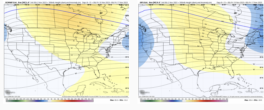
The ridge in the center part of the country does shift eastward, but it levels out a bit, which we can see a bit in Days 14-21. There’s also hint of a western ridge redeveloping, and then both models do somewhat agree that the last week of the month is expected to be colder with an eastern trough and an active pattern.
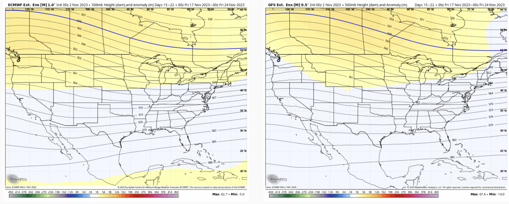
Overall there should be more cold intrusions through the month, which may peak very close to or just after the holiday, but still some finer details that need to come through…