The global pattern continues its shifts with the ENSO neutral cycle taking shape and we’re going to continue on a cooler than average pattern heading through Day 14.
Temperatures at the surface level (local airports) are running roughly 1-3 degrees above average so far for March, but may start skewing cooler for the last 7 days of the month with the active pattern coming in and several snow opportunities.
Beyond that, we’re not seeing much overall change.
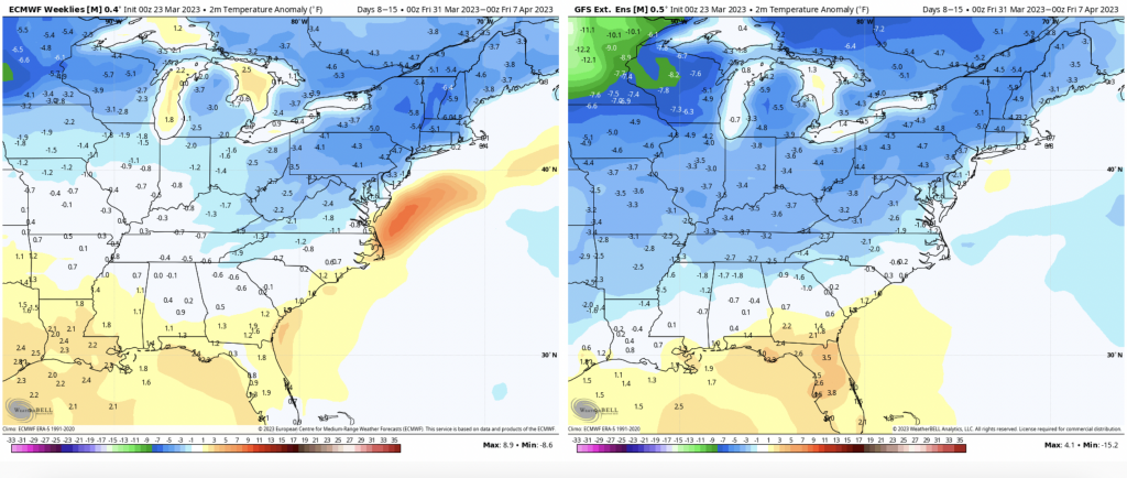
We’ll have some wintry systems, some non-wintry systems with an overall active pattern continuing through the first two weeks of April. And to be honest, I don’t see any major warmups through the month of April itself, with temperatures staying seasonably cool in the east.