The latest ENSO cycle reading came in this morning, and we are officially in the positives, leaving La Nina fully behind since the week of February break. However, the overall atmosphere is still showing weak La Nina trends, as it takes a couple of weeks to bring the change from sea surface temperatures to the global patterns.
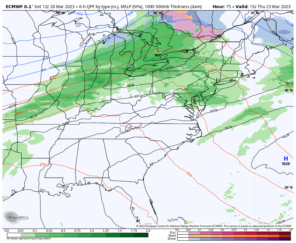
We are expected to stay in this ENSO neutral pattern through the summer. The active east coast looks to reengage beginning the end of the this week as the atmosphere continues to shift to more of a neutral ENSO state. There are two areas of energy we’re watching for the week ahead, one for Thursday and one for Sunday.
There’s not much cold air with the piece of energy on Thursday – the NAO has shifted slightly positive and therefore we don’t have much to hold in the cold air. We could have some cold air damming into NH & ME, but otherwise more rain expected with this one.
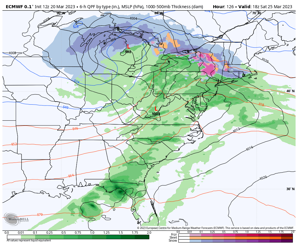
However, the NAO dips negative on Saturday, and that’s going to change the game for the system coming in later Saturday into Sunday. While we may still see some mixed precipitation with this one, it’s inherently colder.
The coastal low will develop late Saturday night into Sunday, which should change most precipitation over to snow in this scenario.
We still have 5 days for some details to flush out, and some models have try to connect the systems together, so there are still some changes to likely to come.
There’s still another storm signal for March 28th as well…