The week itself is fairly quiet. There’s a low pressure to our north that is somewhat stalled, and that’s what is keeping a fair amount of breeze and intermittent snow showers in the forecast through Thursday in New England. The storm pattern takes energy from the Great Lakes into the Mid-Atlantic at this time, but only one system comes through, which is Monday evening…bringing some light snow (or rain in far southern PA) into Monday evening.
This quiet time reenergizes the pattern into the end of the week, and unfortunately there is little consensus and a myriad of scenarios that have been playing out. The eastern trough is returning from the east, which is a pattern change that the models are struggling with. I will say the GFS has been first on board picking up on storm systems, and then eventually the Euro comes along with a better depiction in Days 3-5. Here’s the possible scenarios for Friday/Saturday.
Below is a look at 4pm Friday and Saturday
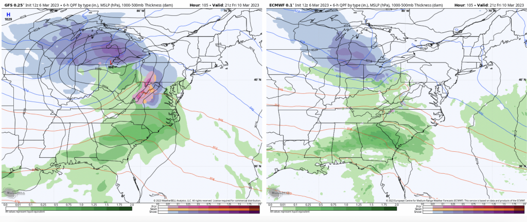
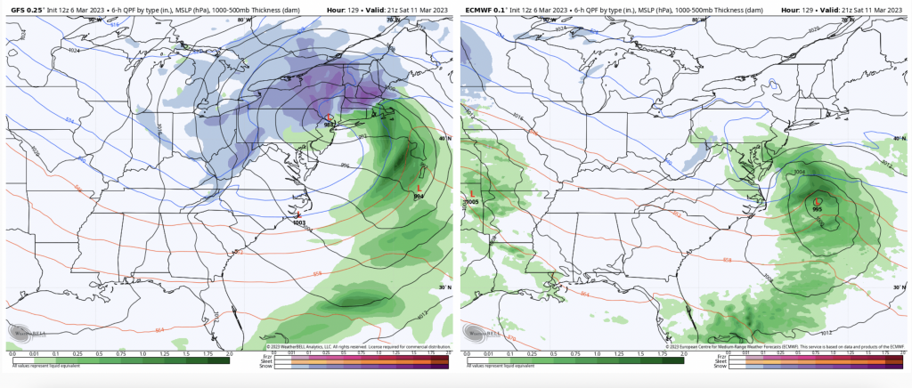
Notice the different storm tracks/evolutions. The Canadian is somewhat in the middle. The difference is that the GFS digs in to the polar jet stream (northern jet stream) and provides the momentum for a strong coastal storm. The Euro/CMC do not connect with it at all, or not until much later when the storm system is offshore.
The pattern remains active and on the cooler side of average into next week. March continues to remain interesting…