We are one week into the more progressive, warmer pattern that marks the after effects of the historic cold outbreak this time last week.
Overall the pattern has been active with ebbs and flows in the temperature, therefore it hasn’t been a constant blow torch of warmth. The week before February break will be on the warmer side again, with the week of February break being the transitionary period. There’s still some discrepancy of the timing of the true pattern change, but instead of having 3-4 days warm and 2-3 days cooler, we’ll start to see that switch over that week, with a stronger trend toward cold as we finish out the month.
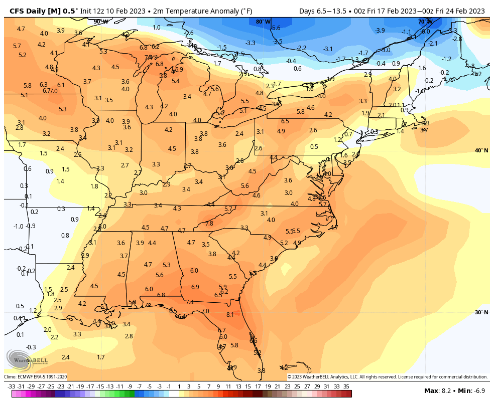
I chose the CFSv2 because the teleconnections support a little more coolness around Feb 20-23 based on the WPO & EPO turning neutral to negative. Those are the Pacific oscillations and typically negative trends indicate cooler air masses infiltrating the east. However, AO & NAO (Arctic Oscillation & North Atlantic Oscillation) remain slightly positive, which means as storms come in we may not be able to hold cold in the Northeast, though the Great Lakes may be in a better position.