The main focus of the week ahead is the possibly historic arctic air intrusion Friday into Saturday. This will be some of the coldest air felt in quite some time when you factor in wind chills.
Ahead of that, we’ll have a brief round of fairly cold air, settling in Tuesday and Wednesday before a quick rebound in temperatures Thursday ahead of the arctic blast.
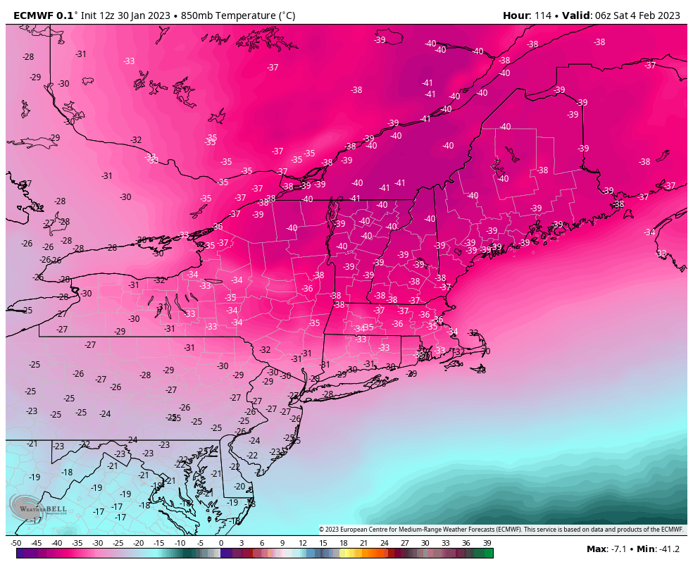
I touched base with Tony Vazzano earlier today as I saw -40C 850mb temperatures forecast, and he said the last time he remembered seeing that was in January 1981. I was not born yet, so there’s not much of a frame of reference for me. But clearly it’s been a while, and I realized that in terms of putting together a forecast, this was the first time I had to remind myself that C & F converge at -40. No conversion needed.
Nonetheless, especially for northern New England, we will be encountering dangerously cold temperatures and wind chills Friday night into Saturday. I don’t use the word “dangerous” often or lightly, but this is unprecedented cold.
The Mount Washington Observatory believes its coldest records are in jeopardy Friday night into Saturday. Boston’s temperature won’t be far from its all time low of -18.4F degrees.
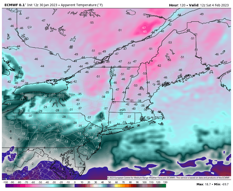
You will likely see Wind Chill Warnings being issued for a wide swath of New England and Wind Chill Warnings for much of the Northeast and Mid-Atlantic not covered in the Warnings.
Often times we see an arctic air mass barge in and the wind calms quickly – therefore it’s cold but somewhat tolerable with sunshine and still air. This will not be the case. Wind will remain gusty for about 36 hours after the cold front comes through Friday morning. Gusts at base levels may reach 40 mph across the Northeast on Friday. They’ll gradually dissipate through the day Saturday. Wind chills Saturday morning range from the negative teens in the Mid-Atlantic to -60 in New England.
This will be less severe in the Great Lakes, as the core of the cold passes north before ejecting into New England. We’ll still see temperatures below zero for Thursday night and Friday night before moderating Saturday ahead of some light snow Saturday night and Sunday.
Temperatures should begin moderating in the Northeast on Sunday as some light snow will graze the area along a front. The Euro is less robust with this but still brings temperatures back up to more tolerable levels to begin the second week of February.
The good news, for now, is that I don’t see any major flip, at least at this point in time, to the other extreme. Often times this does happen. While we will be warmer into the second, and possibly part of the third week of February, we’re only talking roughly 1-2 degrees above average for temperature anomalies. In addition, the “warmth” does look to wane toward the end of the month.