Our week ahead has a couple storms to feature. We have a Tues/Wed system, a Thur/Fri system, and another that will come sometime late Sunday into Tuesday of next week.
This is the week we transition out of our current pattern. However, the pattern change isn’t one that’s going to put us into the tundra. The overall pattern remains colder; we’ll have less “warm” days but it doesn’t mean they’re eliminated from the pattern. It’s possible we see some more arctic air in the final days of the month, but that’s still 2 weeks out and is highly dependent on our storm pattern.
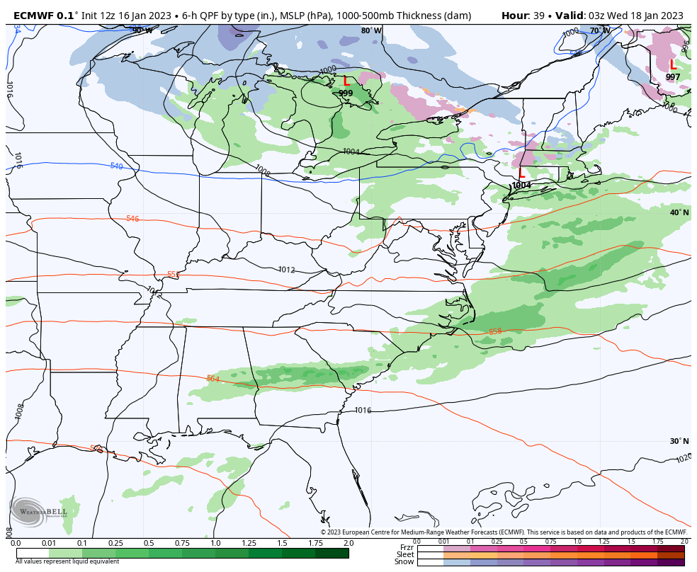
Back to this week, the Tues/Wed system overall is on the warmer end. We’ll be seeing rain/snow in the Great Lakes on Tuesday before it moves east and brings very light snow, ice, and rain to the Northeast Tuesday night into Wednesday.
A cold front comes through with this system on Wednesday, but will only have a shallow effect on overall temperatures, as there’s not much time for cold to settle before the next system comes in Thursday.
Snow begins in the Great Lakes on Thursday, while we’ll still be seeing rain in the Mid-Atlantic. The transition zone will be near the Catskills to southern Vermont, where we may start as snow but eventually mix or change to rain (for S. NY – central/northern NY & southern VT will likely stay frozen).
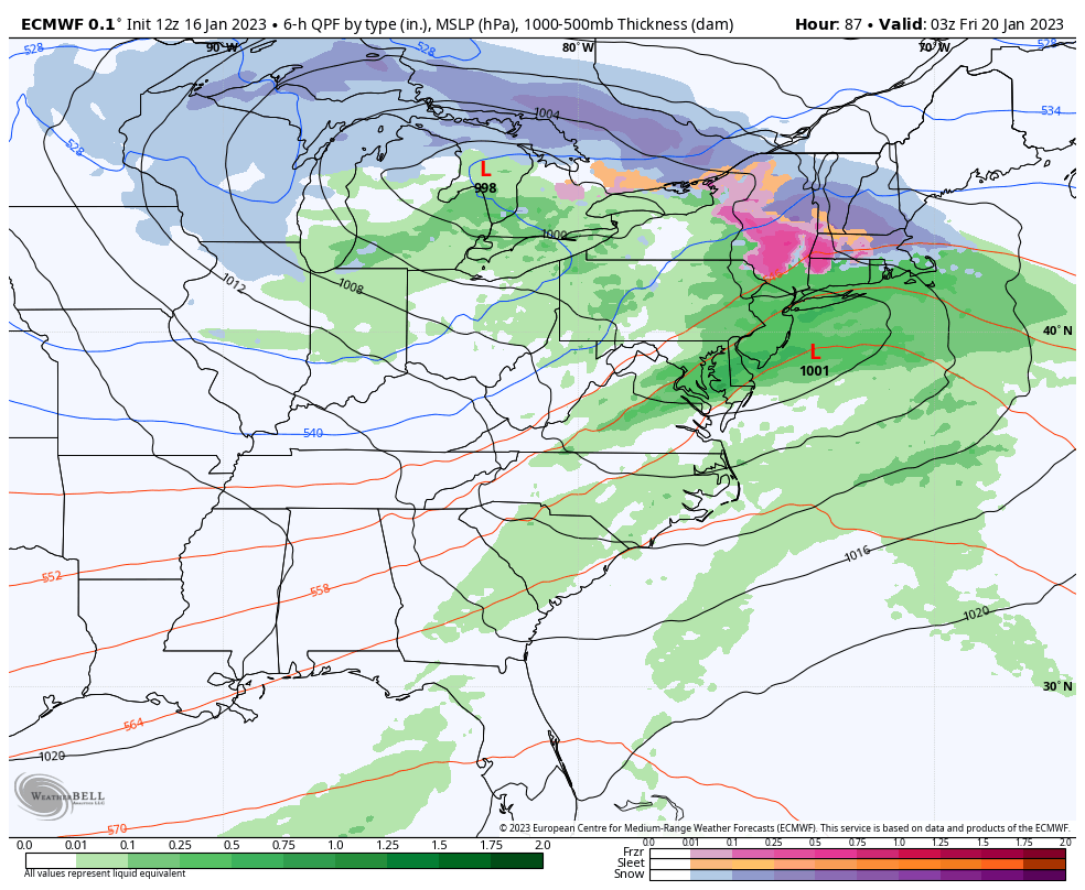
The NAO is negative for the Thur/Fri system, and therefore we’ll have a little extra help for keeping colder air in the picture. Most of NH, northern VT and ME stay all snow for the entire system.
The upper level energy circles around for a while, keeping snow showers in the Great Lakes and Northeast through Saturday morning. This may add several inches to the typical upslope favored areas.
We’ll have an influx of colder air behind this system, though the depth depends on the timing of the next system. In addition, the NAO shifts positive for a couple days.
Therefore the timing of the system Sunday-Tuesday becomes very important. The GFS has a warmer system for the NE as it brings the precipitation later Sunday. The Euro has a colder system, but pushed farther offshore for Tuesday, which makes sense if the NAO is heading negative.