Heading into the week ahead, we have one system that all eyes are on. This is going to be a strong, impactful system for all areas, and especially where we are going to see rain in places we just saw high amounts of snow.
It’s the tail of multiple low pressure centers, which is historically a hard one for models to adjust to as there’s usually some energy transfers that we can’t see until it’s actually happening.
Snow begins in the Great Lakes on Wednesday with a northern stream piece of energy digging down into the Mid-west, while along the coast we have a southern stream piece of energy moving up.
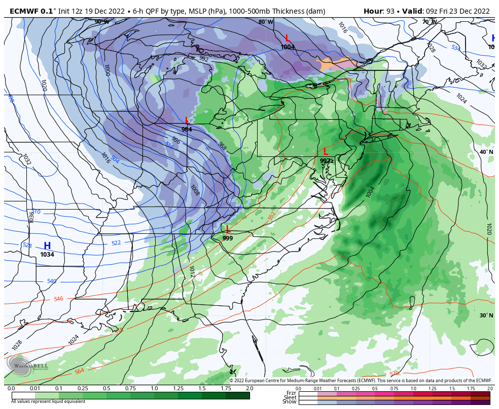
Later Thursday, a piece of energy swings down from the Pac NW, digging into the system over the Tennessee Valley and bringing rapid intensification. This is too far west to keep snow in many locations on the east coast. There’s some cold air damming that will try to hold on in parts of NY, VT, NH & ME, but it’s likely not to hold very long unless the high pressure is stronger than anticipated by models.
We’ll see substantial snow in the Great Lakes, upwards of double digit snowfalls are expected before the storm finishes up Friday, with lingering lake effect snow for several days behind it. In addition, there’s the possibility of a quick burst of snow in the Mid-Atlantic after the rain. The remainder of the Northeast is likely to stay most wet, not white for this particular system with upwards of 3″ of rain possible and even some thunderstorms.
Behind this system, we’ll have a hard crash of temperatures, likely leading to a flash freeze. In areas that see rain, temperatures drop 30 degrees in ~6 hours as the arctic air mass comes through. Christmas will be quite cold, but quiet across the east.