The week ahead is fairly volatile and full of freeze/thaws events as we can’t quite get the pattern to settle, or the storm track to shift east. There are no massive warm ups but several events have more rain than snow followed by sharp dives into somewhat arctic air.
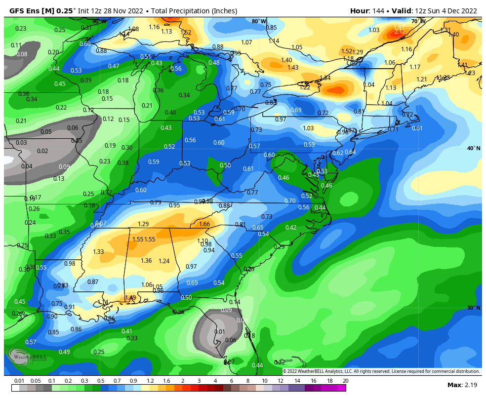
We already experienced this briefly Friday, and again on Sunday. The next round arrives of Wednesday/Wednesday night, where higher elevations may see a switch to snow in New England, but mostly rain elsewhere in the Northeast, Mid-Atlantic, and even the Great Lakes. Temperatures drop quickly into Thursday before moderating Friday, and we do the dance again on Saturday. Upwards of 1-2″ of rain could fall from these 2 systems before all is said and done in New England, closer to 1″ in the Mid-Atlantic, and around .50″ in the Great Lakes, with the majority of rain coming from Wednesday’s system.
The silver linings are that we will have moments in between the rain events where it gets cold enough for snowmaking/resurfacing windows, the typical upslope snow areas will get some snow behind each system, and that there is an end in sight to this pattern. In a little addendum to the long term blog Friday, it was easy to see the cold becoming bottled up into the central/west. That now looks as though it’ll be dropping into the eastern half of the country come Dec 8/9 for a more prolonged return.
Another item I’ve been keeping my eyes on is the ONI (Oceanic Niño Index), which bumped up to a moderate La Niña level for a couple weeks before dropping back to a weak La Niña level last week (and steady there this week). With NOAA’s forecast of ENSO neutral by late winter (Feb/Mar/Apr), we should start to see some changes to the pattern in the next couple of weeks.