After a prolonged period of cold, we’re now in a little break period, which is necessary to avoid extreme temperature movements.
I’ve decided to focus on the GFS again as it has handled the early winter patterns well. We’ve seen the GFS pick up on changes in storms and timing about 24-48 hours before the Euro.
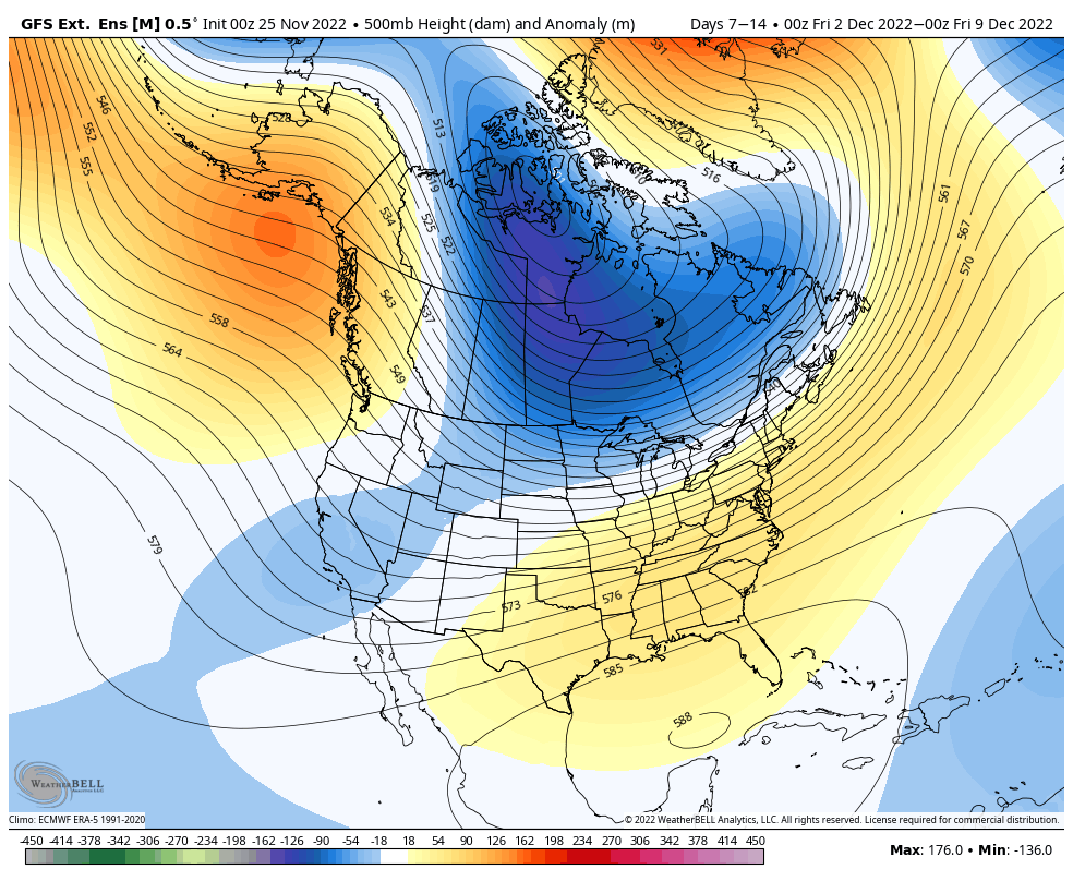
We’re not in a full eastern ridge right now (given that it tapers off in the Northeast and is centered in the Southeast), which means the storm track won’t be ideal for most scenarios. It’s not impossible to have a favorable track, given this is a 7 day average, but more often than not, the Great Lakes will see more opportunity for natural snow out of storms than the Northeast will.
However, temperatures aren’t far from normal and if anything, are running a little below normal for the week ahead. Therefore we’ll at least have some snowmaking windows to capitalize on.
The center of the cold is in the central part of the country and in the Northwest, but we’re not entirely warm in the Northeast and even Mid-Atlantic.

This is one reason I believe we have some opportunity for some favorable tracks for storms, but not all. Between the temperature expectation and the pressure anomalies, it overall looks to be a volatile long range. I don’t expect us to “settle” into a pattern, but rather we’ll be seeing switch-ups every couple of days with an active storm track.