With many resorts turning on the guns (consistently) for the first time in the past week, getting natural snow, and even opening for the season, the long-awaited cold pattern is sticking around.
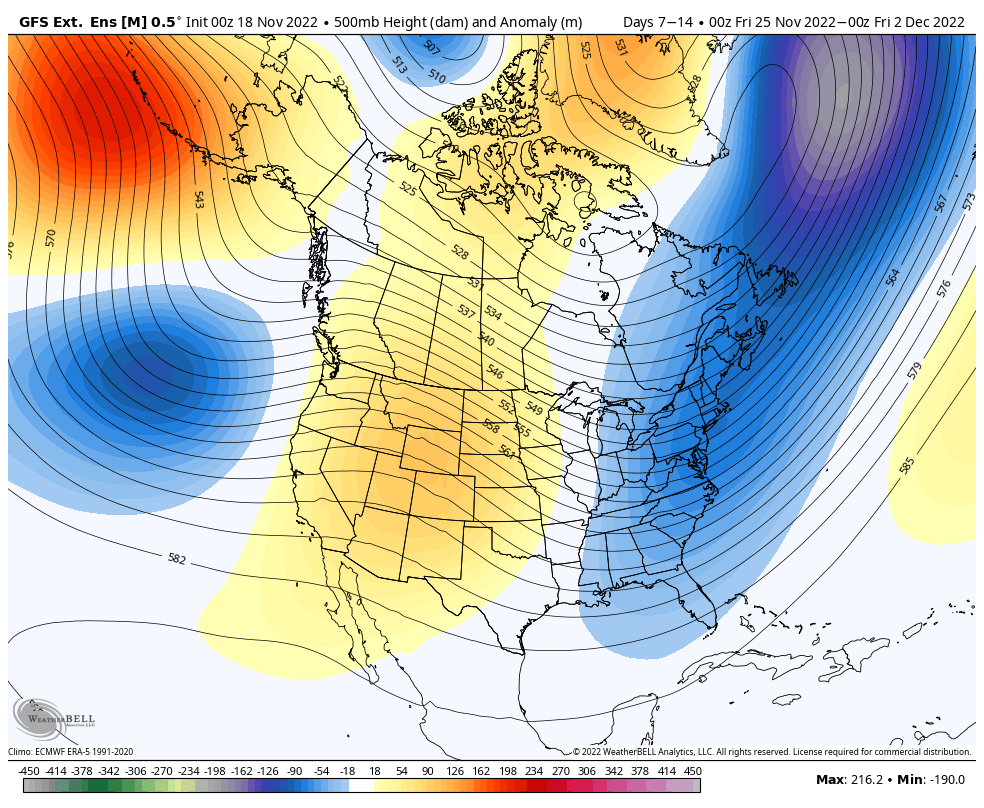
A stronger cold punch arrives Sunday 11/20, and likely again on Sunday 11/27. The expected eastern trough should hang on through the final days of the month and into early December.
This overall pattern is crucial to the storm track for the system developing the day after Thanksgiving. Models have been toying with whether the incoming northern stream piece of energy (in the form of a cold front) finds an accompanying piece of energy in the southern stream, and develops into a much larger coastal storm. This would lead to an impactful system late Friday into Saturday of the holiday weekend. Timing of each piece of energy will be critical.
Beyond the first couple days of December, I’d expect a little break in the consistent cold, but long-term projections do have it settling back in fairly quickly. The break would be a good thing; as weeks of prolonged cold patterns often have a greater tendency to flip more significantly in the other direction. If we can incorporate minor episodes of “warmer” temperatures, an overall cold pattern is wholly more sustainable.