We are finally turning the corner after a warm weekend headed our way.
The first infusion of cold comes quickly next week (11/8), however sustained cold will begin coming in surges beginning next weekend (11/12). The pattern will be active and there are still pieces of tropical energy that are roaming around the Atlantic, therefore the long-term remains a bit uncertain when it comes to the consistency of the cold, how deep it is, and how far south it will extend.
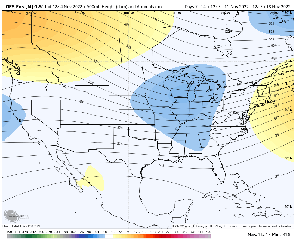
The European model has been the least bullish on cold, which is its normal bias. However, I’ve been keeping close eyes on the 11/8 infusion, and the Euro has been shifting more toward the GFS cooler solution. Therefore I’m giving the GFS a bit more credibility in its long-term.
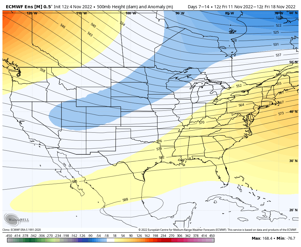
It’s clear to see the differences in the two model outputs. The Canadian model, which usually handles cold events fairly well, leans more toward the GFS solution for the 11/11-11/18 time frame.
Beyond the point, the overall pattern should remain on the seasonable or cooler side. There could be small warm-ups here and there, but we shouldn’t be seeing anything close to our current pattern for quite some time.