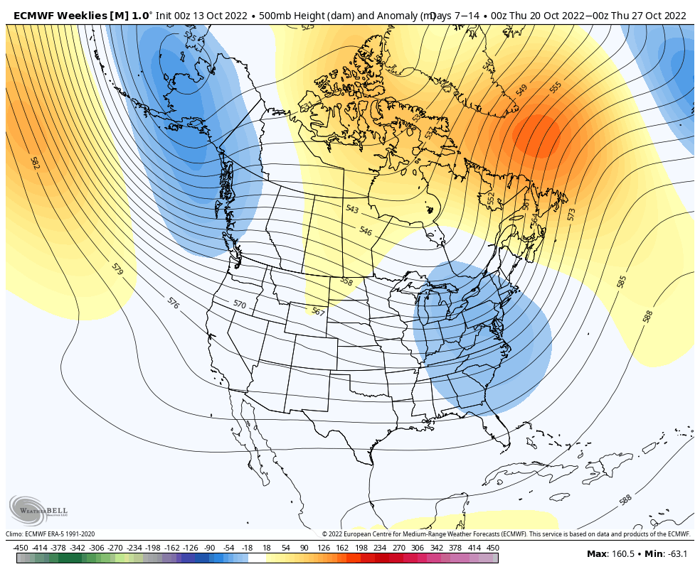
As briefly mentioned in the long term blog last week, a lot of the cold depth and geographical movements can be altered by what’s occurring in the tropics. With activity still apparent this week and into the next week or so, it’s not surprising that the once-seemingly-robust cold burst next week is getting a little less exciting as time ticks by. While it’ll certainly be a cooler intrusion of air, the -7C 850 temps we were seeing forecast earlier in the week are now -4C at best. At the 925mb levels, we may not see much below 0C.
We’ll be on the tail end of the cooler air this time next week, with some moderation likely coming for the remainder of the month.
The better news is that signs do point to a more consistent cooler pattern evolving as we get into the first week of November.