We’re back to blogs! It’s been a somewhat gradual movement into the fall season. Despite relatively lackluster colors from the summer drought in most regions, we’ve kept temperatures fairly seasonal and extremes to a minimum.
The first major frost/freeze came through New England this week, and one more cold shot is on its way for the weekend. It may be accompanied by a few snow showers, to possibly provide “snowliage” to some high elevation areas.
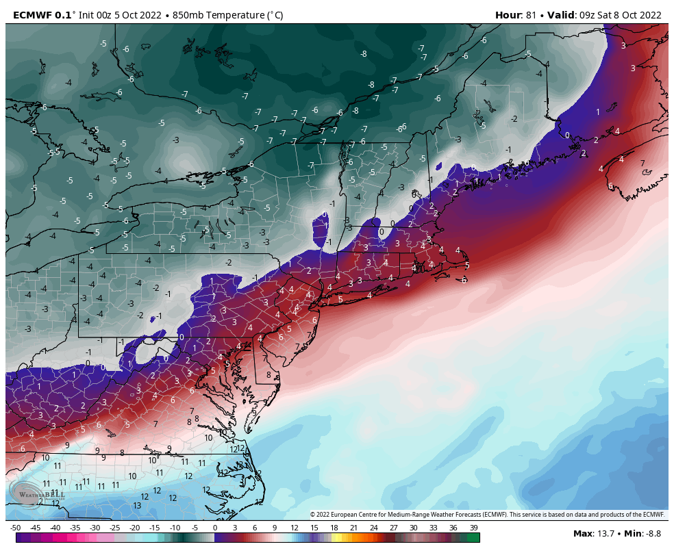
The core of the cold settles in Saturday morning, but “deep” cold found in NW Maine, northern NH, VT and NY (<-5C) will be very short lived. We’ll keep 850mb temperatures, which are typically ~4,500feet, around -3 to -1 through the weekend, before the cold departs on Monday. It looked as though there will be another dip in temperatures toward the middle and end of next week as well, but may not be as deep.
I closely watch the tropics in this time period – the longer the tropics are active, the longer it will likely take for cold pushes to come in and settle into the northern tier. We’ve quieted momentarily post-Ian for the cold push this weekend, but since we’re still seeing activity in the tropics, the cold retreats fairly quick. Therefore at this point, I don’t expect the next significant cold punch to come in probably for at least another 2 weeks.