The main shift in the pattern actually comes in the next 7 days – which is a substantial cool down settling in Sunday through Tuesday. Beyond this, we do have some moderation, but it is tempered just a bit.
At this point in the year, cool downs are less impactful given the higher sun angle and extending daylight hours, therefore colder air masses aren’t as “cold”.
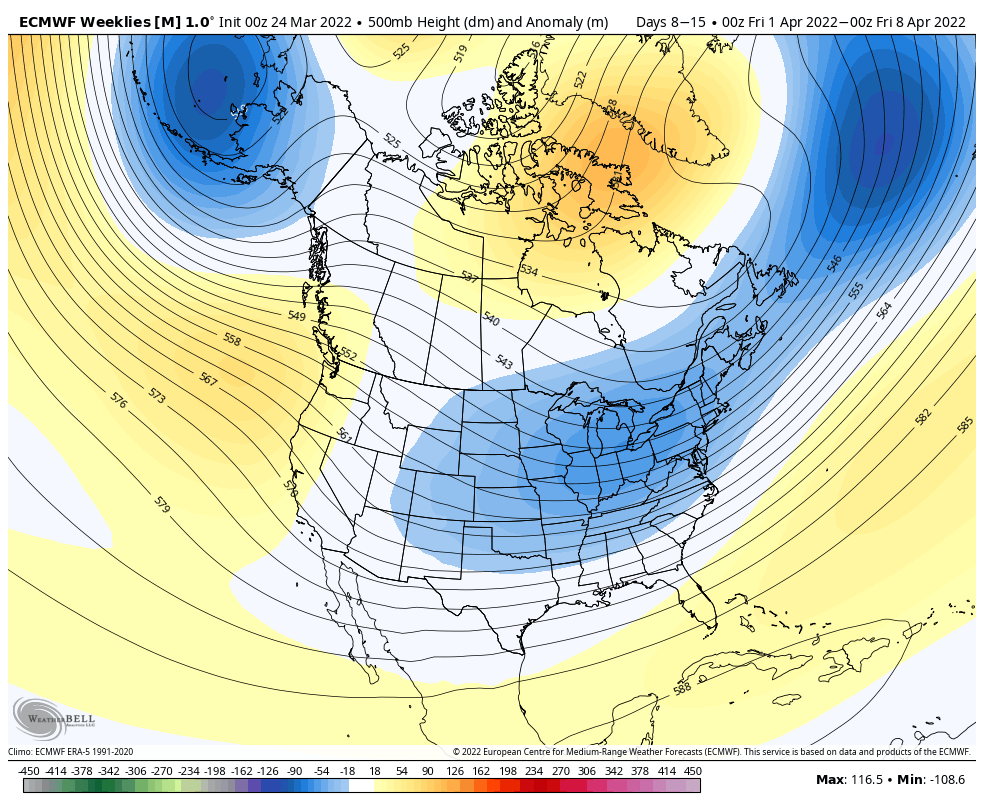
The overall pattern through the first week of April is seasonably cool; there’s somewhat of an extension of the trough that develops during the last few days of March.
An active pattern will stay in place along the east coast but remaining more quiet in the Great Lakes with the trough centered there.
The NAO and AO remain slightly negative and move toward neutral, which still gives the possibility of inside runners, or cold air not being able to sustain itself as systems moves through.
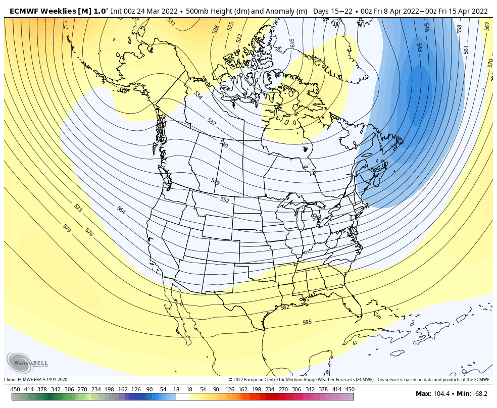
The trough looks to lose its ground heading into the second week of the month, which will likely lead to some gradual warming. While no major rounds of heat are expected, we’re not seeing any signals for sustained cold or outbreaks aside from the last couple days of March.