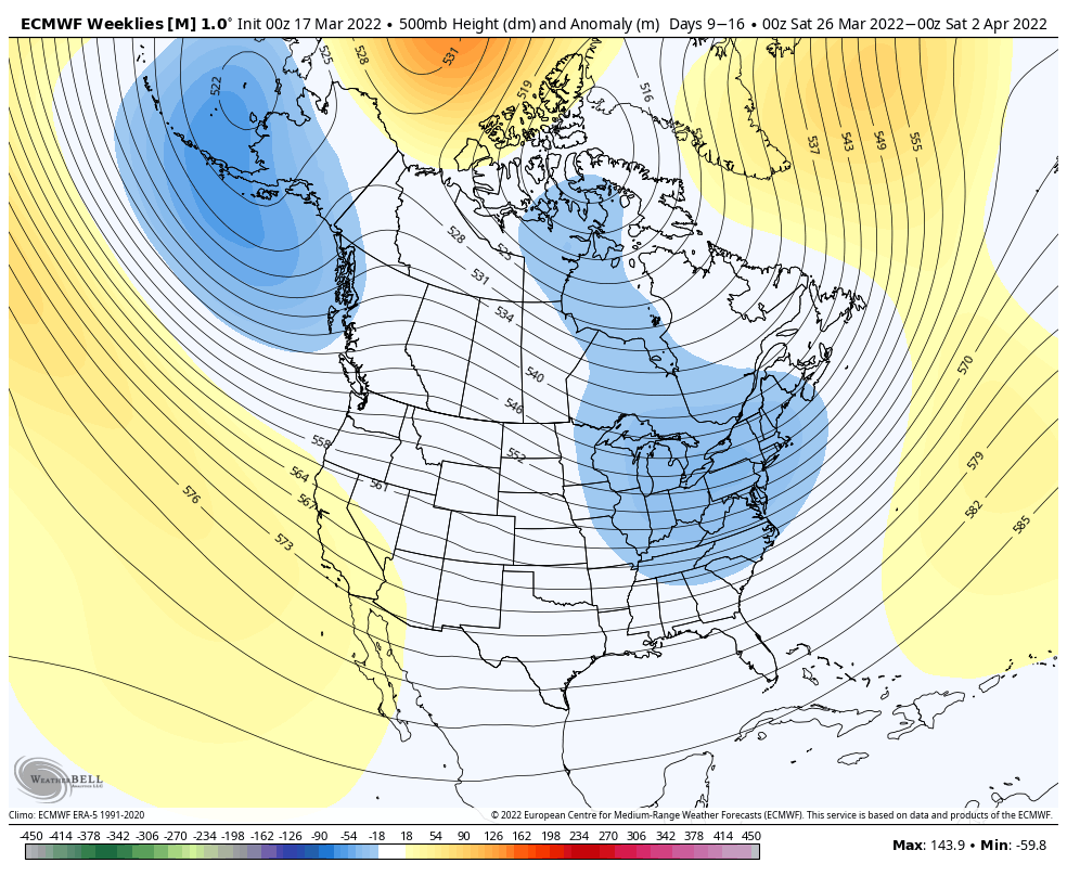
The pattern continues its volatility into the end of the month. We’re going to see somewhat of a cooler pattern into next week. The AO stays fairly neutral and the NAO stays slightly negative to neutral, which does allow for the opportunity to see some pockets of cold and even snow. Of course heading into late March and early April, it’s harder to see snow events when the variables are marginal.
It does look like the eastern ridge tries to rebound into the first two weeks of April, but the Euro is less excited about the strength of that feature and places it farther offshore. This would lend itself to a stormy Great Lakes pattern, but could bring more inside runners to the Mid-Atlantic and New England. No major warmups anticipated in this time frame, but gradual warming is expected heading into mid-April.