This week features three pieces of energy that will impact the eastern region – the most impactful of those systems likely to come over the weekend and unfortunately, there’s not a large amount of agreement on it.
First, we have an elongated boundary that’s strung out across the Great Lakes Monday afternoon, bringing light snow showers along it. That boundary moves into the Northeast on Tuesday, with a weak wave of low pressure rounding the base of the boundary, likely bringing some rain and snow to the area. Most of this will come in the late evening hours Tuesday through sunrise Wednesday morning.
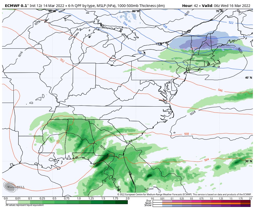
Areas along central NY, southern VT and NH will likely see rain at the base for this event. Summit and mid levels should keep mostly snow, but mid levels may be a very wet snow. Southern NY will see all rain, and it’s not very impactful at all to the Mid-Atlantic.
After this system passes, we have warmth building and another low pressure developing to the south (we can see it in the SE in the image) – that is not expected to bring more than a few showers to New England, but possibly some more organized rain to the Mid-Atlantic. The track is still a bit wobbly, but can’t be ruled out for Thursday night.
The final piece of this week is a storm coming over the weekend. There are large discrepancies in precipitation type, track and overall structure of this system, and therefore low confidence. We do have an NAO that is dropping fast this week and eventually going negative. The Euro/Canadian are running the colder solutions, but the GFS has a more negative NAO, therefore I’m not really buying its “widespread rain” solution at the moment. Will continue to follow this one through the week, but my hunch is there will be some snow/mixed precipitation that develops, though rain will still be on the table for all areas at some point over the weekend.