This storm has been an interesting one to watch develop – a lot of moving pieces and components make a huge difference to the forecast.
For now, it’s clear that most mountain areas will get snow at some point. Most of VT, central/northern NY, northern NH and far northern ME may not see a drop of rain. However, once we get south of that, it’s a little more dicey because of the orientation of the storm itself. We’ll definitely see some rain in PA, southern NY, southern NH, and central and southern ME & MA.

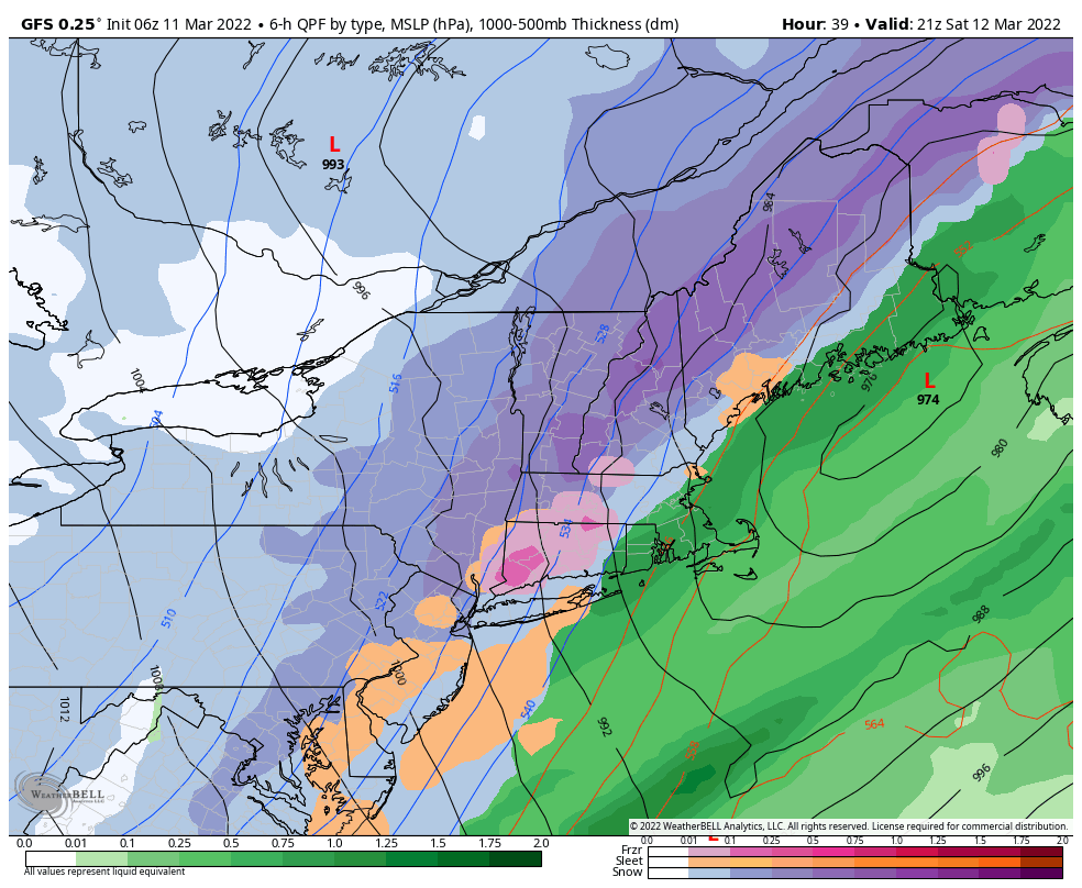
It took the GFS a little while to see the colder component of the system, but now it’s shape and orientation is the closest to what I’ve been expecting out of this storm. The NAM is very similar. The Euro wants to bring more snow to the coast (and thus less mixing for the aforementioned areas that could see rain), but I’m not buying it for now. It’s very hard to go snow to rain in most cases, especially early season and late season. The dynamics are that much harder, especially late season and during the day.
Spatially I agree with the GFS Kuchera output from the 6z run this morning. The amounts are on the lower end, but I’m not sold on super high ratios for the main part of the storm with how much changeover we’re looking at, so I think this depiction will play out really well. Of course, slopes that are favored for upslope snows behind a system will see snow (and higher ratio snow) after 10pm, and could amount to several inches given the wind field on the back side of the system.
That will be Sunday’s issue – the wind. The heavy, wetter snow from the onset of the storm will be helpful to keep some of the snow on the hill, but there will be plenty of blowing and drifting too.