
Heading into the first weekend and second week of March, it looks as though we’re going to have a little reprieve in cold shots after the succession of them in the upcoming week.
This is a little different than what we had seen last week for the 3/4-3/11 time period, but this is likely because the 2/25-3/3 time frame is overall colder than expected, and the pattern is recharging. It does line up with the PNA signals we saw last week, so it’s not entirely out of the blue.
Therefore I wouldn’t be surprised to see some temperature moderation in the 3/3-3/7 time frame, as we start to shift back toward a colder pattern for mid-March.
Not ironically, most models do have a non-snow system moving through around 3/6-7, which would be the pattern changer (most likely) heading into mid-month.
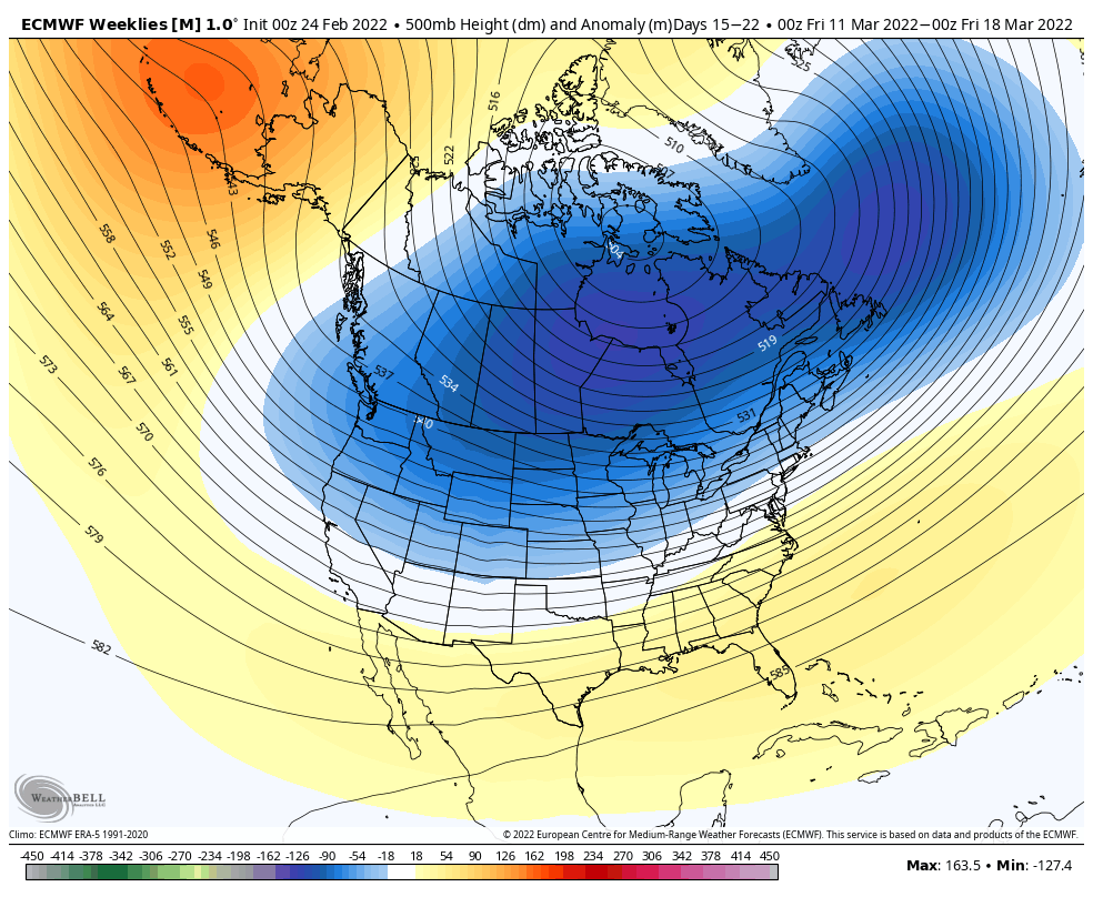
The Euro Weeklies see this pretty clearly, and honestly keep an eastern trough in the forecast for quite some time, which is rather odd for the Euro – but signs that we could be seeing winter last a bit longer into spring.