A quick note on the long term views ahead of the holiday weekend…
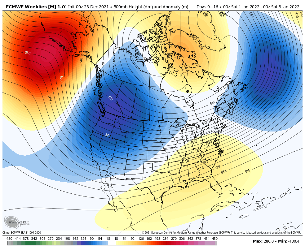
After a temperate week between Christmas and New Year’s, it’s likely for us to see a return to some cooler temperatures for the first week of January. We have the SE ridge that continues to build in the coming week, and starts to get squeezed out of the picture during the first week of January, similar to what we’ve been seeing this week. It really confuses the pattern and storm progression, but should allow for more snowmaking opportunity in the Great Lakes and New England.
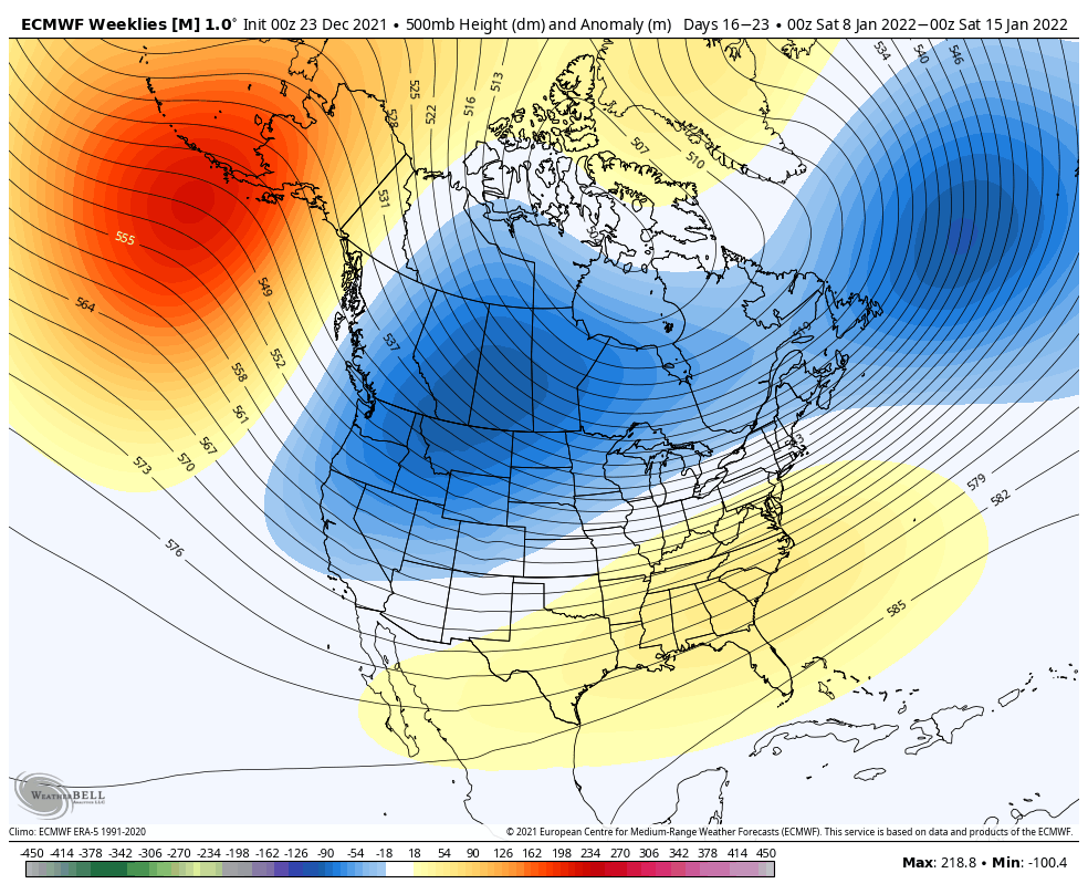
By the second week of January, we see the SE ridge being suppressed more, which should allow for some cooler air to filter down a touch farther south. How deep that trough extends is still a bit uncertain, but there have been some signs of decent arctic air punches that should help with snowmaking opportunities.
Currently, the AO and NAO stay negative through around MLK weekend before seeing a shift to slightly positive readings from both of the oscillations. They don’t go wildly positive, which is a decent sign, but there are some contradictory signs for the second half of the month.
The SE ridge isn’t great for natural snow, so I’m not anticipating much change in that until we reconfigure this pattern, which I don’t think will be until February.
The Christmas system: the low pressure offshore does seem to form and provide some light snowfall to northern VT, NH and most of Maine – a widespread 2-4″ possible with icing impacting southern VT/NH and portions of NY & MA.