We have our first major snow of the season for the east as a low pressure rides along the stalled front that moves through tonight.
While we’re still waiting for our first major snow, this will have to do to get us through Christmas week (although there are some other storms to come before Christmas).
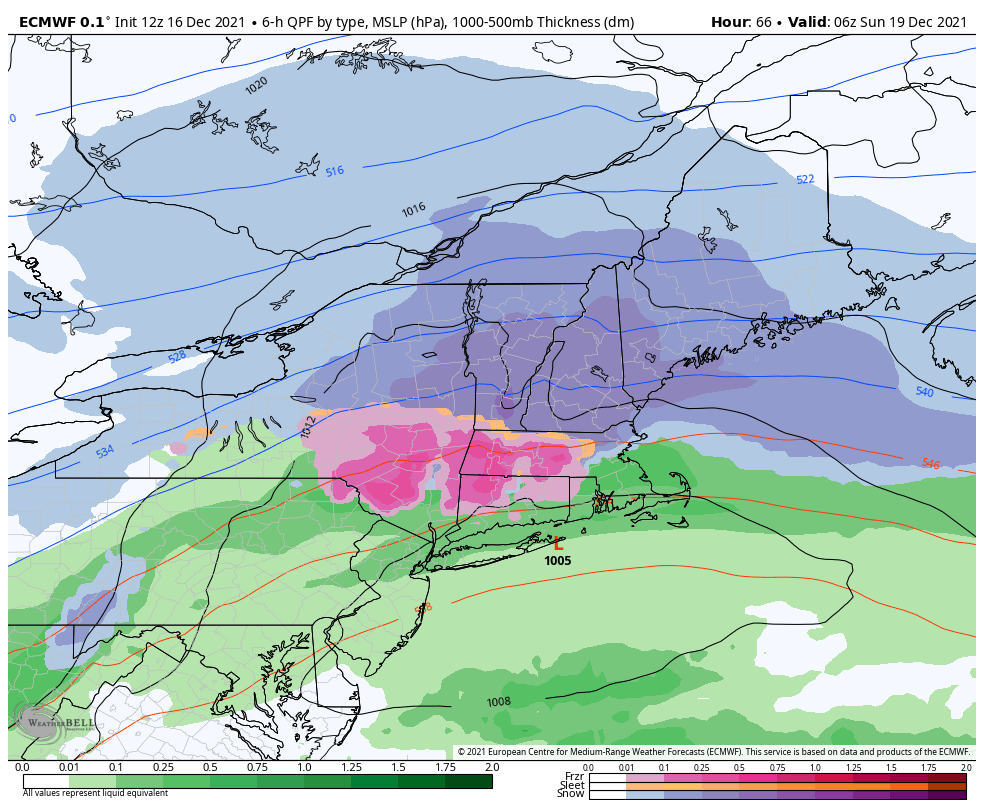
I’m still a little concerned for mixing at Gore, though certainly expected at Belleayre. The deformation zone of the storm, which typically showcases some of the strongest bands of precipitation in the system, is very close to Gore. Because there’s an influx of air into the system, mostly from the south or east, we tend to get precipitation type issues in this zone. That’s why we’re seeing the sleet/freezing rain become more apparent. High confidence in 3-6″, easily 6-8″ if there’s no mixing.
Whiteface will be the winner as there’s no mixing concerns and ratios will be far more favorable the farther north you go. There’s high confidence in 5-7″, but could push 8-9″ at the summit.
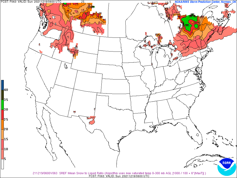
Back to Belleayre, you’ll notice in the snow to liquid graphic that it’s north of the Catskills. Therefore I’m anticipating more sleet and freezing rain for Belleayre. On top of a quick 1-2″, we’ll see some substantial sleet and then some freezing rain.