The pattern has exploded with energy and doesn’t show many signs of stopping. Our Sunday system brought a variety of precipitation types, erratic temperature movements and ultimately takes us out of snowmaking zones (for the most part) until Thanksgiving morning.
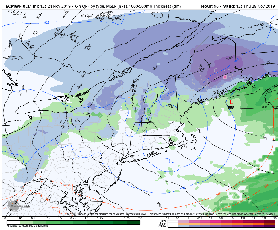
Temperatures Monday don’t rebound much, but we’ll be above freezing at most base and mid levels. Overnight lows do not drop much as the warm front arrives, leading to a warmer Tuesday. Clouds begin to move in on Wednesday ahead of the next system, which again, looks to be warmer than preferred. We’ll see rain for the majority of the event, followed by some snow showers Thanksgiving day with colder air rushing in.
Temperatures will be tumbling on Thanksgiving morning and wind will be highly elevated. We’ll likely see sustained wind out of the northwest 25-40 mph with even higher gusts at the summit. Mid-mountain winds will be 15-25 mph gusting to 35 mph. Wind remains elevated through Friday and we’ll stay cold as well.
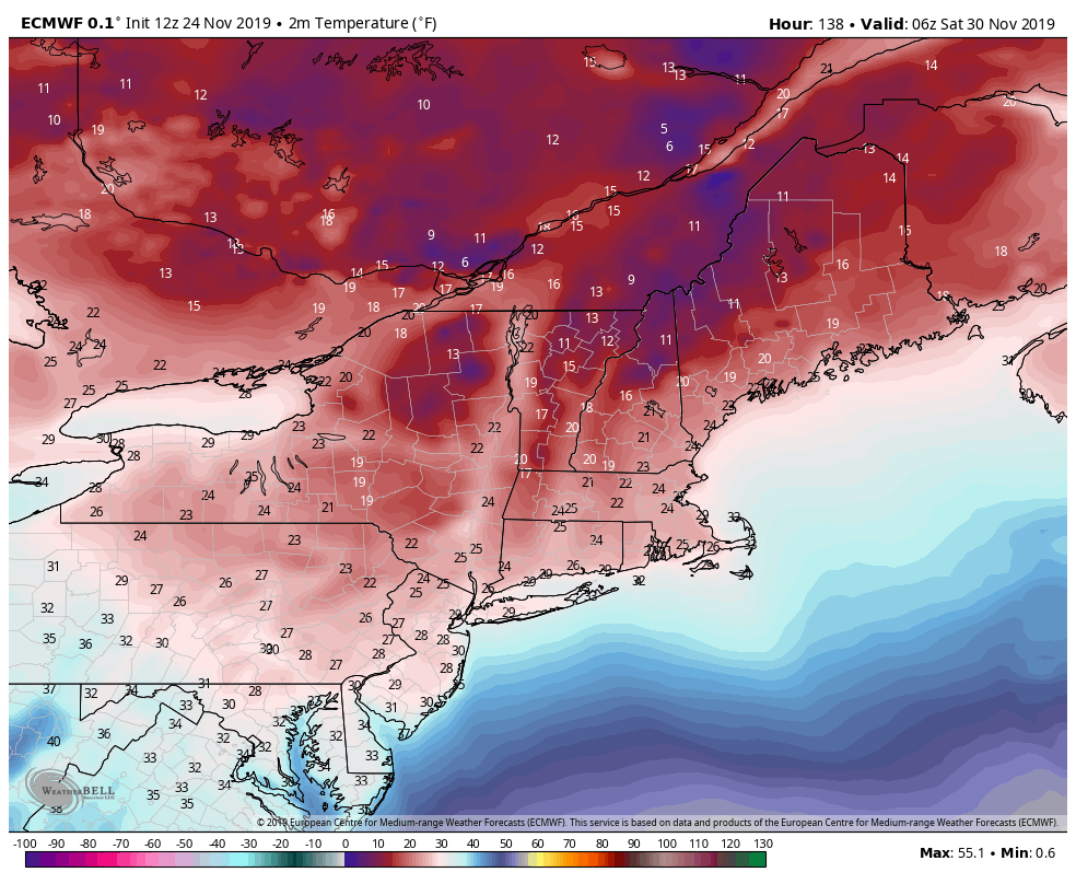
In terms of snowmaking temperatures, we’ll see the majority of temperature falls during the day on Thanksgiving. By Thanksgiving evening, we’ll be seeing the cold settle in deeper to the base levels. We’ll be keeping this cold through Sunday, which means we may have greater than 48 hours of continuous snowmaking for Wildcat, Mount Snow (base may get a touch too warm Friday (low 30’s), and Attitash. Hunter will have overnight opportunities but will lose the opportunities during the day, though the summit may stay marginal. Roundtop doesn’t have much opportunity in this, but there may be some hours Friday night with temperatures in the mid to upper 20’s.
The atmospheric beat goes on – with another mixed precipitation storm. We are clearly on a pattern with Sunday & mid-week storms, and we’re not moving from this. Next Sunday looks similar to what came through today – another mess (as it was last week too – another piece of the pattern puzzle). There are some timing discrepancies, as is expected with a system one week out in the future.
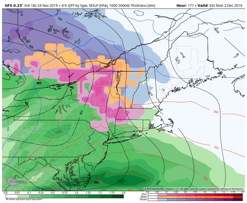
The GFS (shown) waits until weekend operations and the World Cup have concluded, whereas the Euro spoils the fun Sunday morning. Given the pattern we’re coming out of, I’m leaning to a slightly colder solution, at least at the surface. Warm layers aloft don’t really “feel” cold air masses like the surface layers do – with snowpack, structures, etc. which do have an impact on temperatures. The cold behind this system looks stronger than today’s (11/24), so again, I lean toward a colder solution for New England (maybe more icy for Hunter, rain for PA), which ends up being the trend of early December.
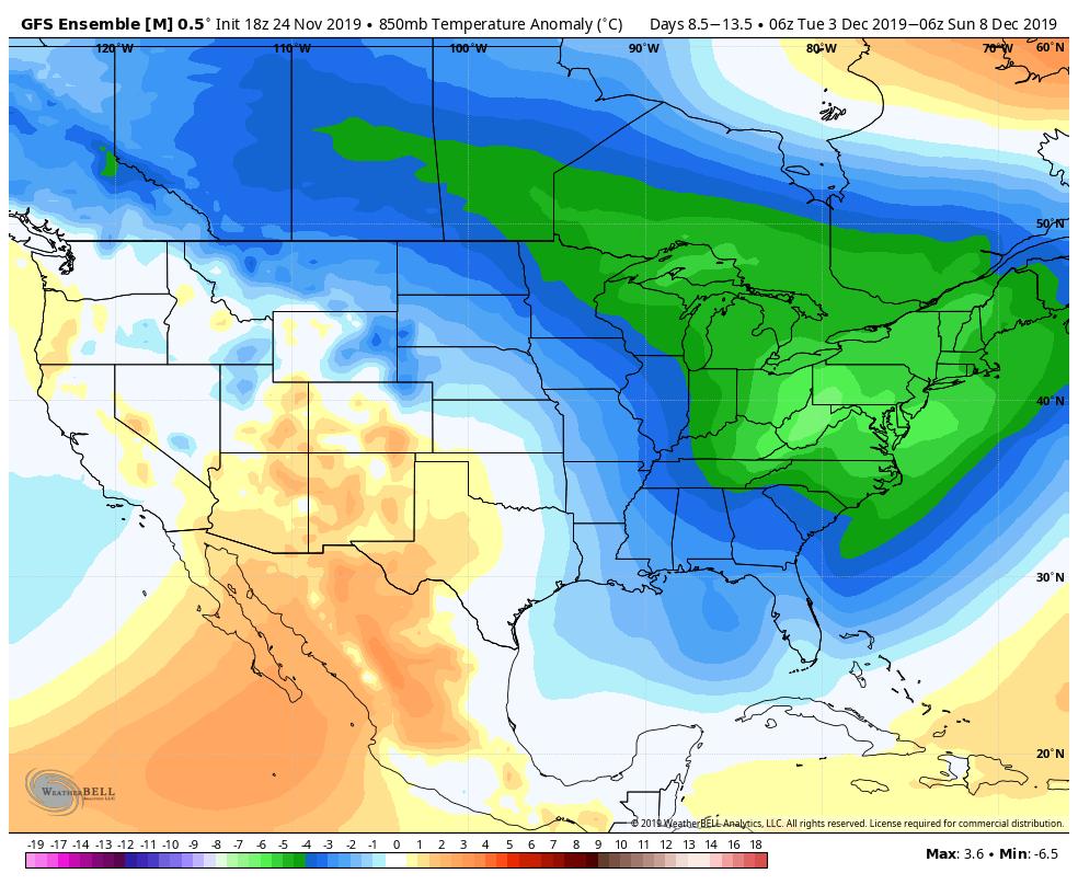
In several blogs and forecast note updates, we’ve pinpointed post-Thanksgiving to deliver more cold punches and continue an active pattern until mid-month. Latest information shows this anomalously cool air invading the Northeast with this active pattern, which sets us up nicely for potentially some natural snow, along with plenty of opportunity for snowmaking. The concern with such cold, and sustained 5-7 days, is that there will be a rebound. My hunch is that will occur mid-late month with the change in pattern. We’ll explore the reason for this cold plunge, the infamous “Stratwarm”, in a blog on Tuesday.