The cold is in and we’ll continue to have some waves of cold bursts in the coming week. We’ve had issues holding the cold, which means we have blocking problems (which was the trend last season), therefore there’s more bad then good coming with storms. However, in between these storms we have cold blasts, which is a silver lining to the warmer storms.
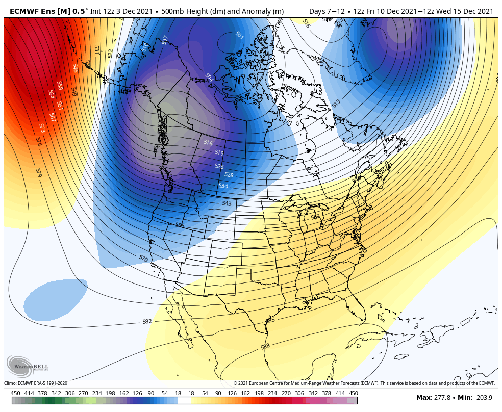
As expected, we are going to start moderating into next week. The trough settles into the west and we have a trough in the east.
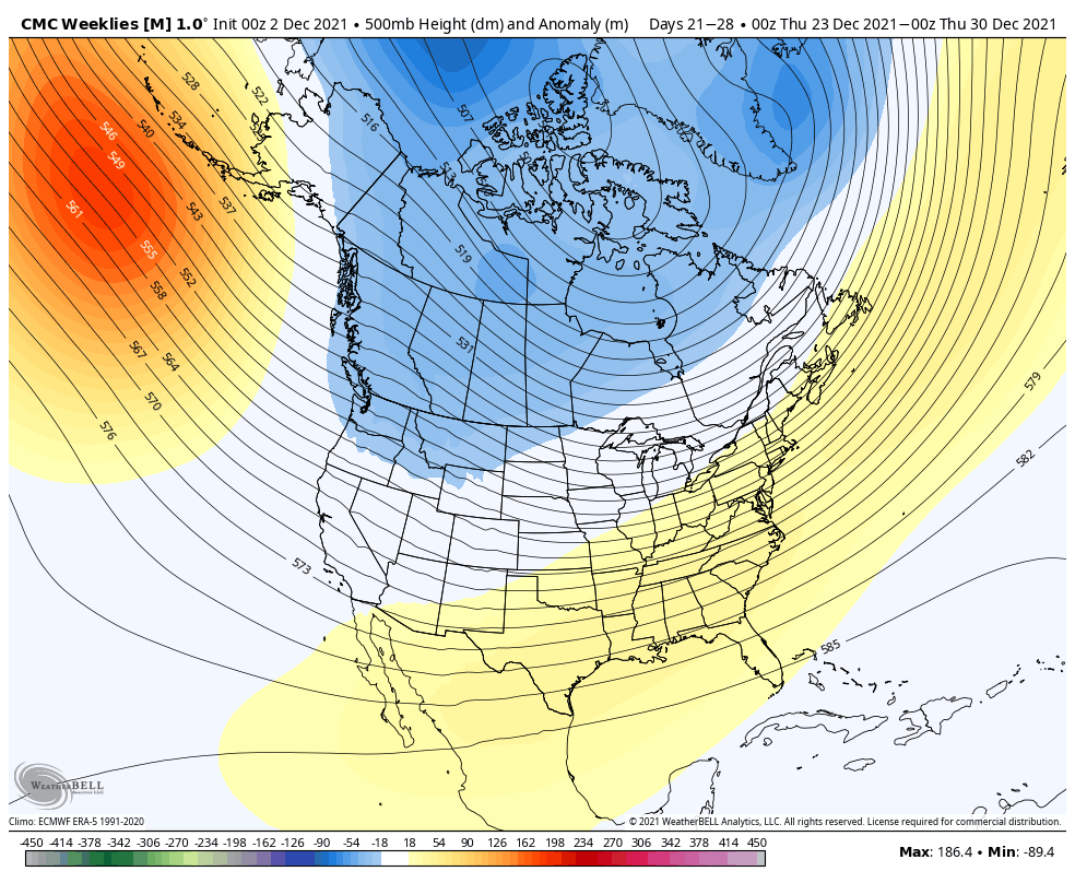
Unfortunately, at this point, we’re not seeing a clear exit of this particular ridge in the east. Initially, it looks like it may be Christmas week but there’s a bit of discrepancy right now. The GFS & Euro continue the ridge in the east through Christmas week, whereas the Canadian model and CFSv2 are more bullish with the cold slightly earlier. We expect the Euro to be warm, but usually the GFS will show some a little sign of cold, which is doesn’t right now. However, the Canadian & CFSv2 have a bias to enhance any cold in the long term, so we’re on the fence. My gut says a little more of the Canadian, because it shows more of a transition, and it’s quite anti-climatological to have a 2-3 week ridge in the East in December.
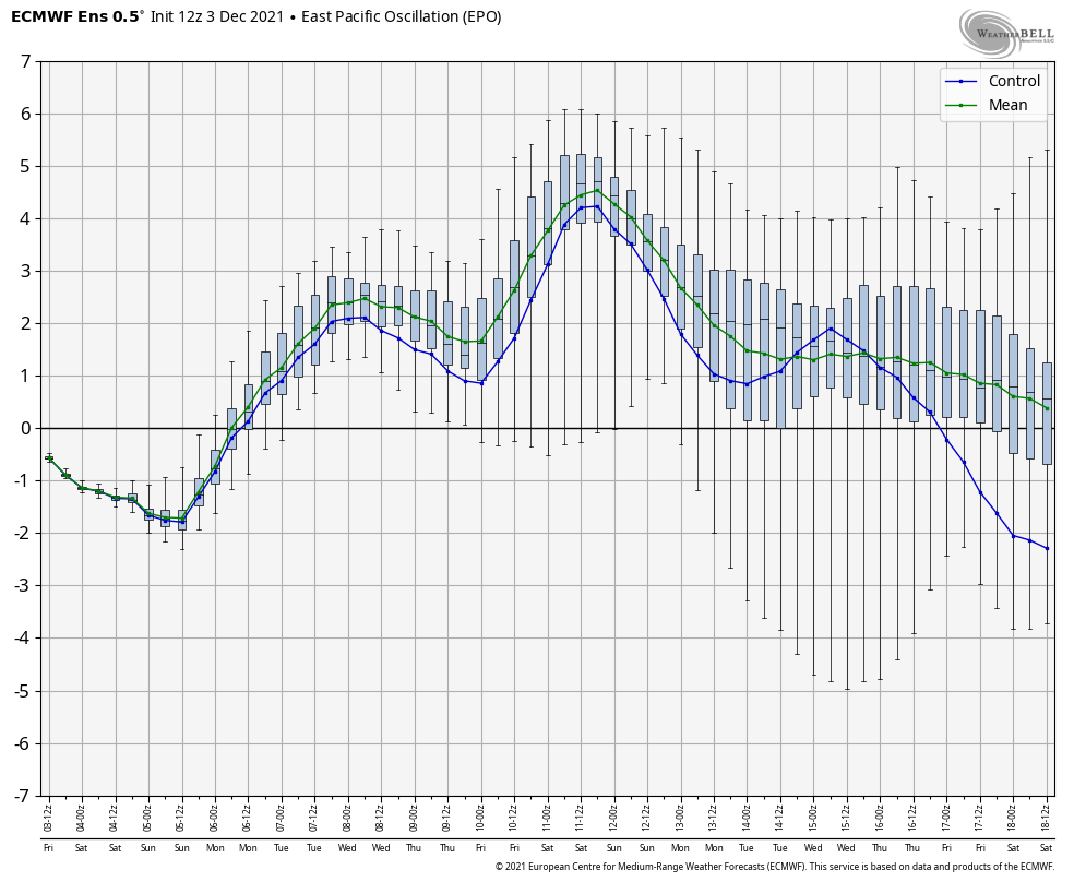
We’re also seeing a downward trend in the EPO – the Eastern Pacific Oscillation – the week before Christmas, shown in the GFS, Euro, and Canadian.
A negative EPO usually implies cold – hence we are in a negative phase right now. I’ll post another blog over the weekend with some more background information on teleconnections. As we get into the new year, we rely on the NAO & AO a bit more.