Our expected cold punch is arriving today from west to east with some significant snow expected in New England as the low pressure gathers moisture and energizes in the Gulf of Maine. Accumulations over 6″ likely in the Green Mountains, with 3-6″ possible in portions of the Whites and into the Maine mountains.
Behind this front and attending low pressure, wind is going to pick up and remain elevated for the majority of Saturday. Gusts will be high enough to impact operations in higher elevations Saturday. Sunday we’ll see those subside.
We have the majority of next week remaining on the cool side with the trough remaining in place. The end of the week bears watching as the base of the trough may shift slightly westward – which could bring a rain event to New England, but snow into portions of the Mid-Atlantic and Great Lakes.
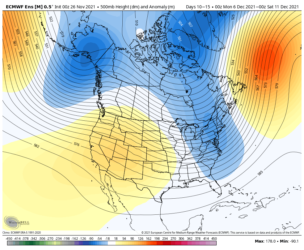
Heading into the first full week of December, the trough looks to remain in place on the east coast. This should provide favorable storm tracks and more cold opportunities. A negative tilt (instead of N/S it’s more SE/NW) to the trough is always a promising sign for coastal storm tracks.
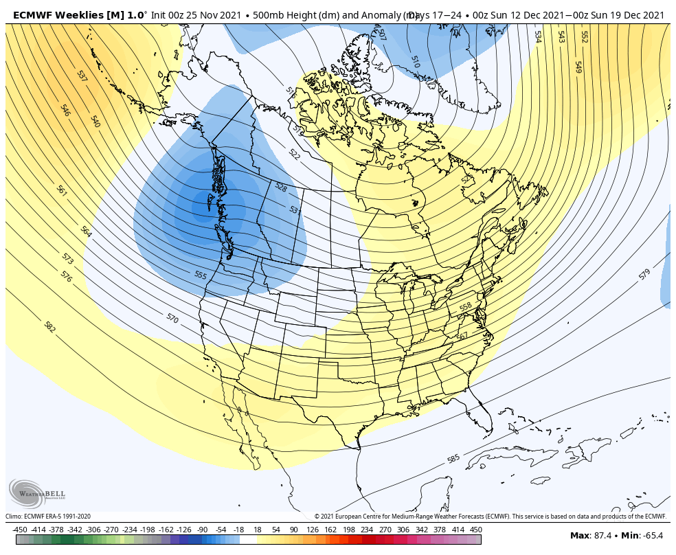
With 3 weeks of cold shots, it’s inevitable that we have a rebound. That looks to happen in the second/third full weeks of December. The good news is that we’re not expecting a blowtorch of a ridge to form over the entire east, but it could be at least a week of above average temperatures heading into the middle of December. Mid-Atlantic and Great Lakes are the most likely to see the warmest fluctuation in temperatures.
At this point, with another stratospheric warming event recently occurring, cold is expected to return around Christmas week. We see the trough ejecting out of the Gulf of Alaska and into the Pac NW by the middle of the month, which should eventually translate into the eastern trough.