The cold is settling in from the cold front last night and we are certainly in the colder pattern that we’ve been expecting. While overall a colder pattern, we still have some ups and downs to deal with. We’ll see that Sunday-Monday this week with the storm and again Thanksgiving Day; each warm up is bookended by a deep batch of cold air.
Heading into Thanksgiving weekend, we still remain in the eastern trough pattern, which means the activity will remain high and cold shots continue.
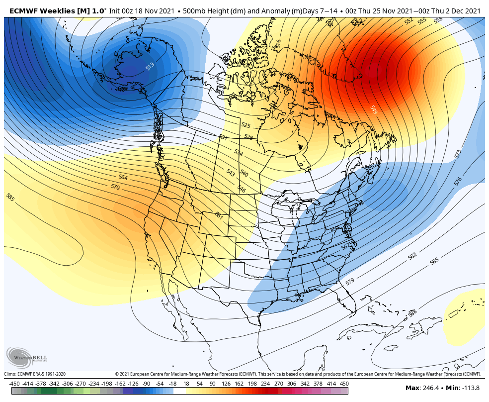
The trough isn’t incredibly deep, compared to the one in the Gulf of Alaska as shown in the Euro Weeklies, but it actually looks to build a bit more with time. An interesting note during this time period is that the NAO (North Atlantic Oscillation) is hedging negative with an inflection point at 11/23 and then heading more negative. That’s in the same time period as our Monday storm, which is leading me to believe that we may actually see even less rain than expected, especially for western New England/Northeast, because the blocking may be playing a bigger role.
(Sidenote: The morning run of the Euro shows this, but I want to see some consistency in the solution before running harder with it. My forecasts have been hedging lower than guidance recently for that reason. But we’ll touch on that Saturday in its own blog.)
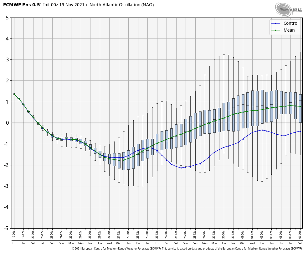
Back to the NAO, there seem to be some clear oscillations in the ensemble members, which signifies some storminess – likely around 11/28 and 12/2. While it’s a little early to be using the NAO with high confidence (usually better accuracy after January), we are certainly getting into the time of year to keep an eye on it for storm patterns and where/when blocking may set up.
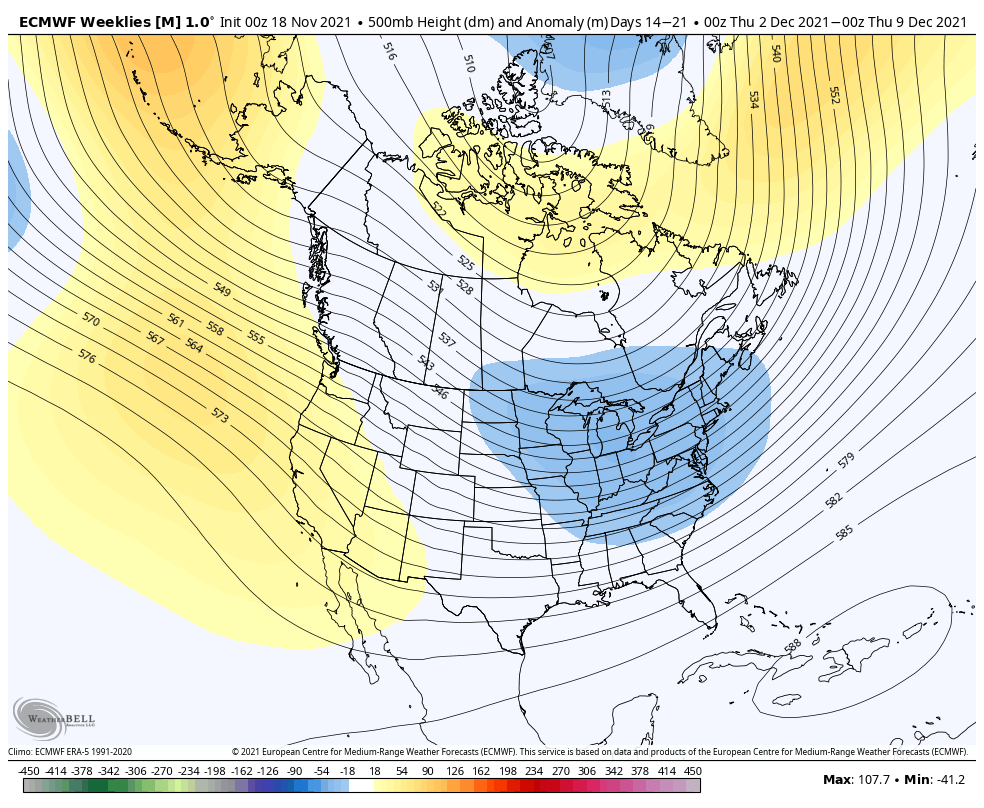
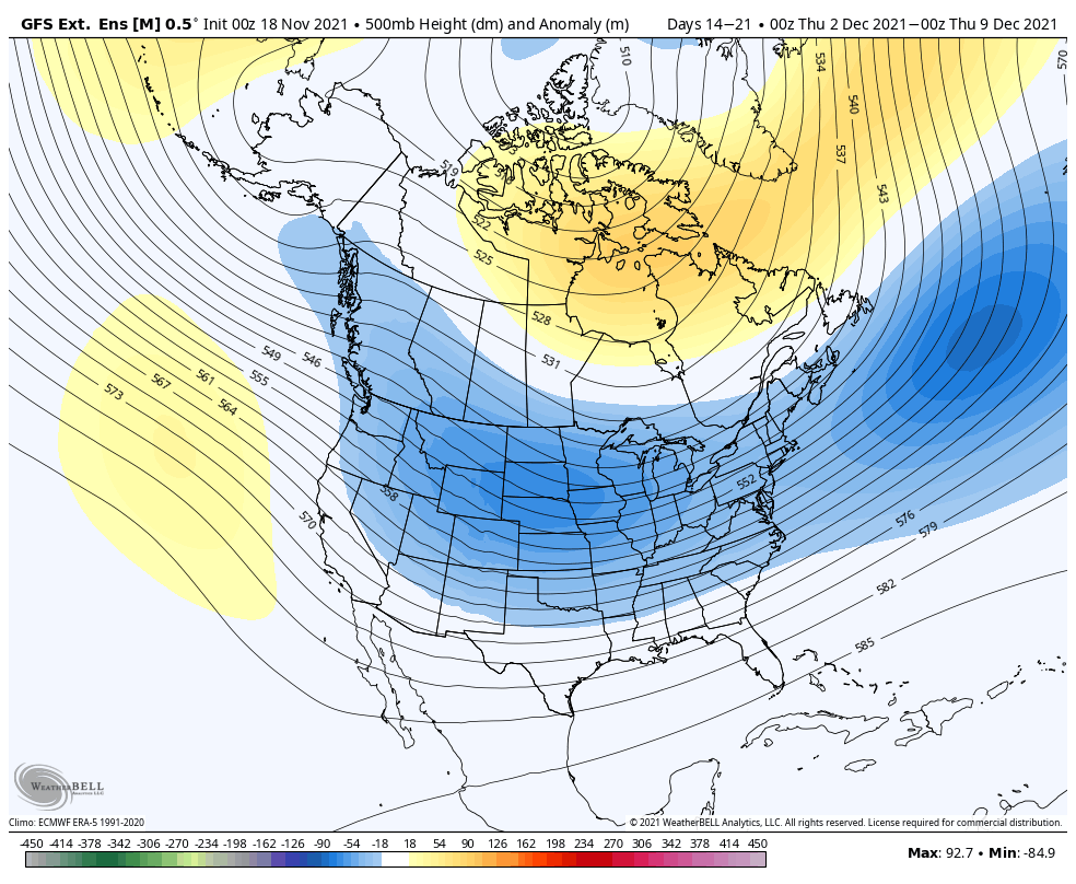
Overall, the pattern remains favorable for more cold than warm in Week 3. The Euro continues the eastern trough, but the GFS is far more bullish with a trough over most the country. With the Euro’s inherent bias of a ridge in the east, this really isn’t surprising. If we can get some better blocking (negative NAO), this is a ripe pattern for some fruitful coastal storms into early-mid December.