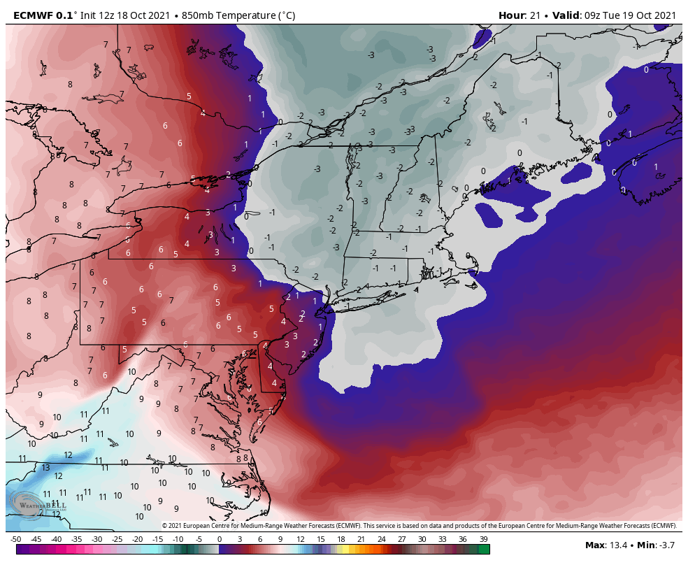
We’re starting off the week with a raw and cloudy forecast, even a few showers (or flurries, depending on elevation) sprinkled in there as well. This cold punch isn’t expected to last long, but tonight will be the coldest night, despite some cloud cover and stray light precipitation. Elevations above 3,000 feet should see temperatures drop at or below the freezing mark heading into Tuesday morning – the core of this cold moves through just before sunrise.
The cold quickly retreats from west to east on Tuesday, and we’re back to more average fall conditions Wednesday through Friday, with temperatures mostly in the 40’s and 50’s through Saturday. There’s not much precipitation expected in this time period – perhaps a couple showers Thursday into Friday. The timing of the next cold front has shifted slightly from Friday night, to later Saturday night/Sunday morning. The depth of this particular batch of cold air looked more exciting a couple days ago. The pattern is more active than previously anticipated, and therefore the cold air is being scooted out quicker. This may change a couple more times in the coming days as those pieces of energy materialize over the west coast.
Will update midweek on the cold, and of course with the long term views on Friday.