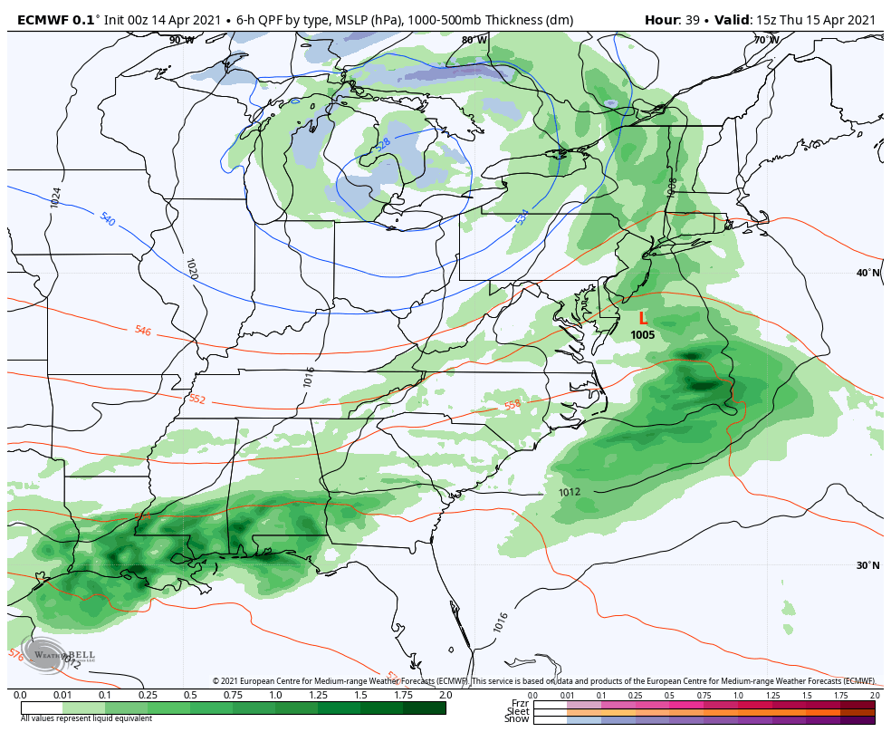
We’ve had a cut-off low in the Great Lakes that’s been circling up there for a couple days now. Combine that with a southern stream piece of energy flying up at the east coast, and we have ourselves a mid-April nor’easter – something we’ve been eyeing and watching for since late last week.
You can see the wheels in motion on Thursday morning 4/15 (left image). The system may start out as rain, but as the coastal low cranks, the cold is streamed in. With counter-clockwise flow around low pressure, it makes sense why the cold is on the northwest side of the low. That air is coming in right from the northeast.
However, this low doesn’t have a lot of motion because we’ve been in a blocking pattern, and this is combining with a cut-off low. That leads to a slow moving system because there’s little overall atmospheric flow, and there are few places for it to move.
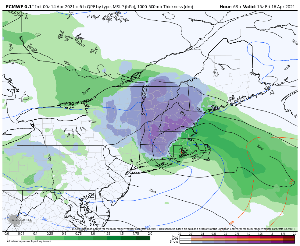
A full 24 hours later (right image), the coastal low has started to crank – but notice it has only moved north – not east. It’s a 991mb low, which surely isn’t the deepest coastal low we’ve seen, but it does enough. This continues the flow of cold air into New England, and actually creates quite a zone of snow over the Greens, Berkshires, and eventually moving into the Whites.
The system does not fully depart until around sunrise Saturday morning as the blocking gives out toward the east. This type of system in February would have been a 36 hour blizzard. There will be some rain for the onset, but the Green & Whites will likely win out on this one. Highest snowfall amounts will likely be right along the NH/VT border to just along the southern spine of the Greens.
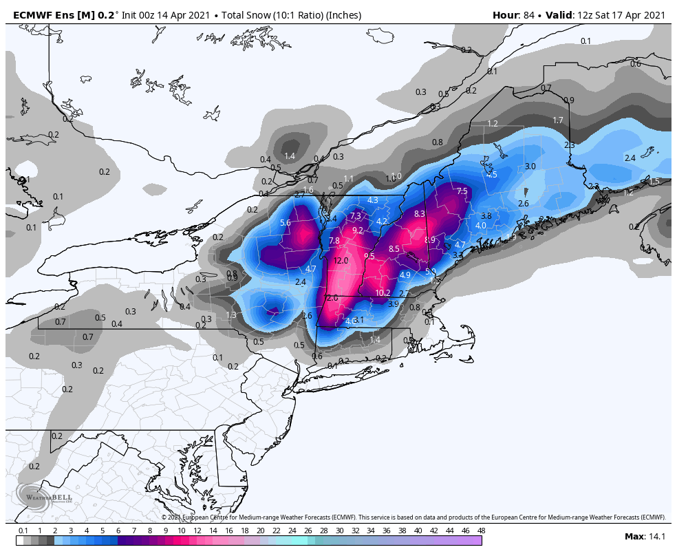
In posting snowfall maps directly from models, I typically look at the location and scope of the high snowfall points, the orientation of the snowfall axis and general “shape” of the storm rather than the actual snowfall amounts – they can differ greatly run to run and be a bit generalized. This is the ensemble mean, and I think it’s done well with placement. Keep in mind this is 10:1 ratio snowfall map, and we will not see 10:1 ratios out of this storm. Snow will be heavy and wet, and I anticipate 7-8:1 ratios instead. Therefore snowfall amounts from a 10:1 map can be cut by 20% or so (the Euro Ensemble doesn’t provide a Kuchera snowfall output, which has a depiction of snowfall with more accurate ratios). The take away from this particular map is that highlighting of high snowfall locations, which are the central and southern Greens, the Whites down to Monadnock, and maybe into the Mahoosucs in Maine. Amounts >6″ look highly possible at this time, especially outside of base levels. This type of snowfall typically leads to a concern for power outages and trees/limbs to come down.