With the warmth of last week, the season is winding down quickly heading into this weekend. It was certainly a season filled with twists and turns from Mother Nature.
Looking ahead to this week and the weekend, we have dueling spring/winter feels coming in with a cut-off upper level low that will keep clouds and some drizzle in the area Monday. We’ll see more pockets of sun on Tuesday and Wednesday, with temperatures bursting back into the 50’s and 60’s briefly before a low pressure moves up the coast.
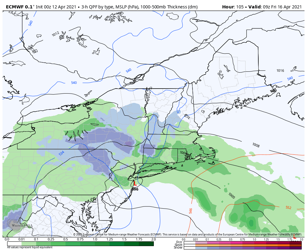
As we touched on in the Long Term Views last week, we can have some interesting features come into play with cut-off lows, and potentially coastal components, which looks to be possible going into Friday. The coastal low drags in cooler air, and that may bring accumulating snows to the Poconos, Hudson Valley and southern/central Green Mountains, and maybe the Whites as the low churns off the coast Friday into Saturday. Unless the low moves farther north, or more energy expands the precipitation field…the precipitation may stay too far south for snow to reach the resorts.
We have a negative NAO through 4/20 and negative EPO through 4/18 – any lagging cold with this upper level low should scatter out shortly after, with a moderating trend into the last 10 days of the month.