The overall pattern looks to stay relatively unchanged in the next 10 days. We have some level of blocking that’s staying consistent in the Northeast which, on one hand, will hold back any long term warmth to just a couple days. Earlier this week we were talking about snow at some high elevations, and now we’re in full spring, almost summer mode for another 12-18 hours.
Next week’s culprit is less likely to be warm, because the low responsible for the blocking will be to our west, instead of our east. We’ll see a low get cut-off from the overall pattern on Saturday, and that’s going to setup over the Great Lakes for the following week. This, in turn will sock us in more consistently with clouds, and possibly some precipitation.
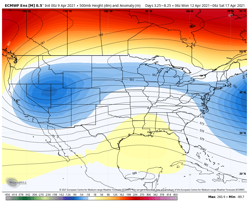
This eventually shifts off to the east, but another omega block looks to possibly form. Both notable models eventually break down the western trough, and hug it into the east, which means days like today may be hard pressed to come by until we get closer to the end of the month.
Upper level lows, like the one setting up for next next week, can have waves of energy develop along the circulation, along will some even developing coastal components. It’s a hard phenomena to forecast accurately in the long term, given that blocking mechanisms are all about timing – which can certainly fluctuate in the long term. Models typically have a tough time with physical timing of energy movements, especially this year with a lack of upper air information. As mentioned previously, blocking can do a number on long term forecasts, since it really disrupts the entire flow of the upper atmosphere.
Overall the long-term is unsettled. The low offshore moved out quickly enough to allow for more sunshine and warmth to intrude for the past couple of days. However once the low pressure to our south begins to invade the area on Saturday, that will be the end to this warm spell. Upper level lows over the Great Lakes are notorious for long-lived dreary spells, but also may bring the possibility of some natural snow if the right amount of cold can move in as well. The AO remains neutral through the week but the NAO is forecast to dip negative around 4/12.