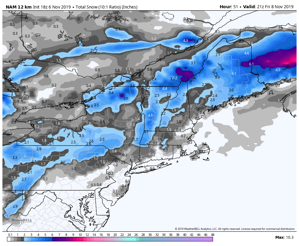
A quick update on the system for the end of the week and the upcoming cold. The storm arriving Thursday will bring minor storm to the VT & NH mountains, potentially to the summit of Hunter as well. Accumulations at the summits look to be about 2-4″ and lesser amounts expected at the base, especially at Attitash.
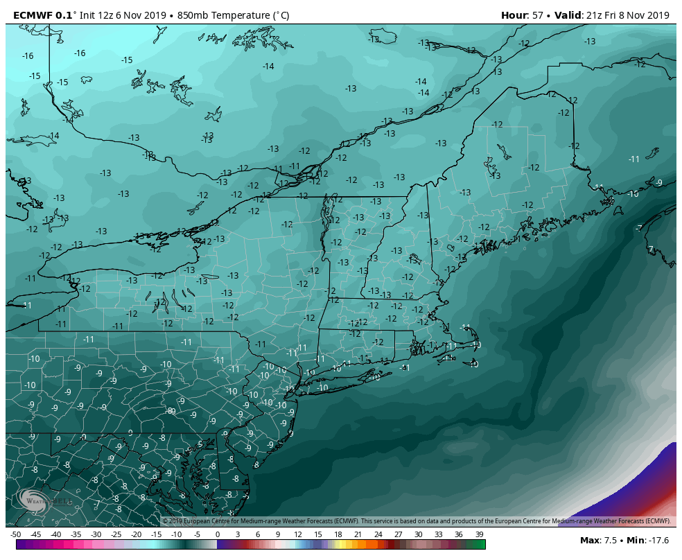
Cold returns on the backside of this system. We have quite the cold air mass coming back in for Friday and it continues into Sunday. The cold retreats momentarily Sunday evening/Monday morning (though Wildcat summit may sneak by the whole time with snowmaking temperatures). Another storm is possible Tuesday/Wednesday next week with more cold behind it.