As the arctic grip lessens throughout today and Sunday, we’re watching our next system come in with some disorganized potential. I say disorganized because it doesn’t look like the classic nor’easter; the phasing is slightly off but good enough to develop a potentially significant snowfall, not only for New England but for much of the Northeast, with only little chances for mixing.
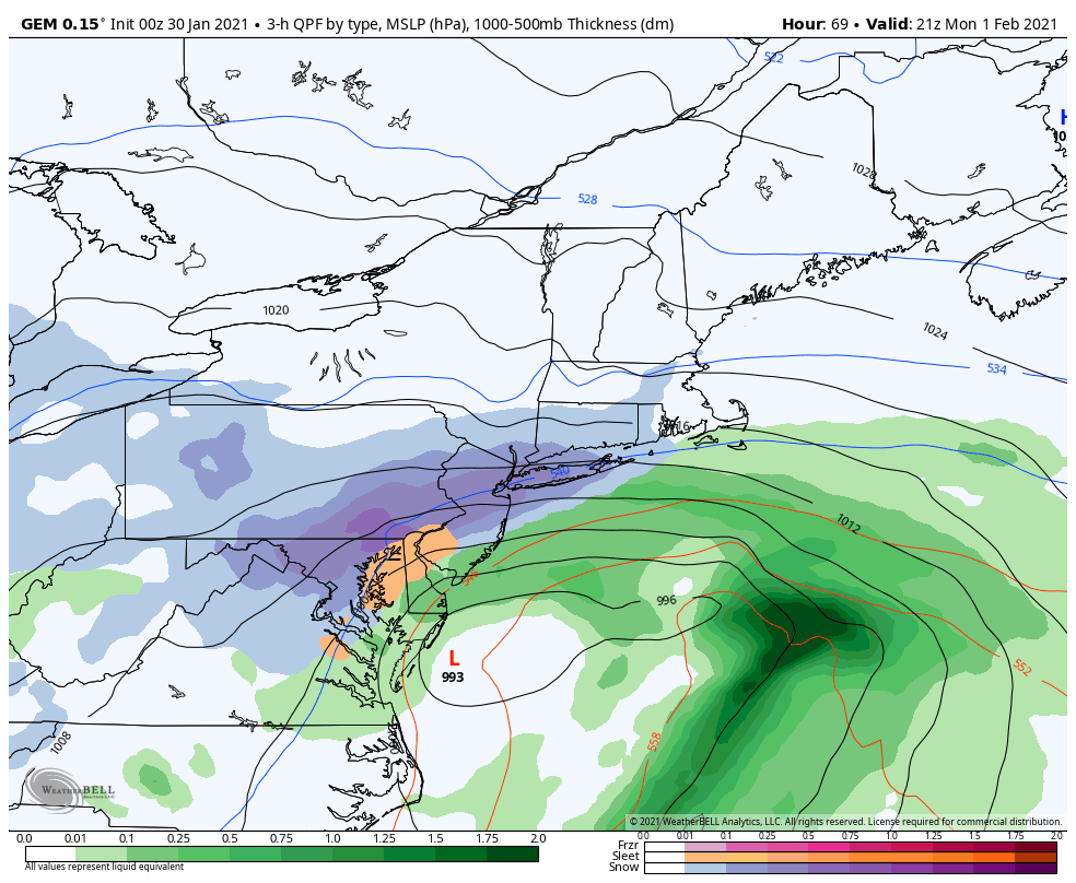
Snow begins Sunday morning for PA resorts, and will be light but consistent with a couple inches piling up throughout the day. Heavier snow bands move in around sunset, with accumulation continuing, but now a possibility of mixing comes in as the coastal low begins to crank up, and swing some warmer Atlantic air into the mid levels. This could lead to a drop in snow accumulation due to sleet and some freezing rain for areas south of the Poconos. As the low moves north, the cold air wraps back in and we’ll change back to snow, with light snow continuing through Tuesday morning and a couple more inches to add on. Total snow for Roundtop & Liberty should be 6-8″, even with a little mixing. Higher amounts are likely if mixing does not come to fruition.
For Hunter; snow moves in overnight Sunday and will shift to a moderate snow fairly quick. Heavy snow banding develops Monday as the deformation zone sets up over the Catskills and brings 1-3″/hour rates of snowfall. The low pressure center barely moves from pre-sunrise Tuesday morning to Tuesday afternoon, which may lead to a rapid intensification of the low. Snow does not taper off until some point Wednesday. High confidence in over 6″, and moderate-high confidence in over 10″ with the current track – longer stalling yields increased snowfall amounts as the banding will include high intensity rates. There’s a slight chance for mixing when the low is closest to Long Island, but looks to be minimal and short-lived.
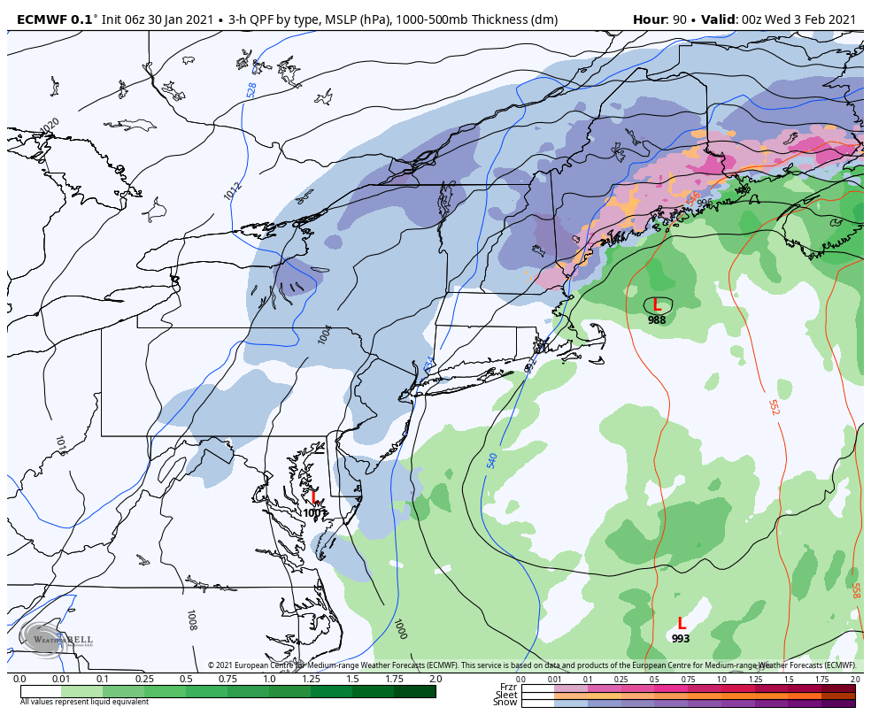
For Vermont & New Hampshire; snow moves in overnight Monday into Tuesday morning. Banding should be well-formed at this point and moves in without much wasted time. The bulk of organized precipitation departs Vermont around 7pm Tuesday, however the wrap-around flow will keep snow showers going well through Wednesday. With the low stalling a bit in the Gulf of Maine, the bulk of the organized precipitation does not depart the Whites until nearly sunrise Wednesday morning. High confidence in 6-10″, moderate to high confidence in 10-14″ including the wrap-around snow showers that go through Wednesday.
Beyond this system, wind will stay elevated through Thursday, before we start to feel the influence of our temperature moderation and next system, which has the potential to be warmer, coming through at some point over the weekend (2-6 to 2-7). There are differing opinions on how this system progresses – but would not be surprised to see some rain involved in it at some point.