We have another quiet few days before the pattern picks back up later this week into the weekend. Ahead of a cold front, we’ll have some warming late in the week, though it’s not expected to be significant warming given the current air mass.
However, we’re watching the incoming front for possible low pressure development, and where this low may develop along the front. This is key as an early phase and development would lead to a rain event for the weekend. A later, or non-phase would be a much better scenario with possible snow or little amounts of precipitation ahead of some incoming cold. With a weakening AO & NAO, we’ll have to keep an eye on how the energies phase a little closer to the event.
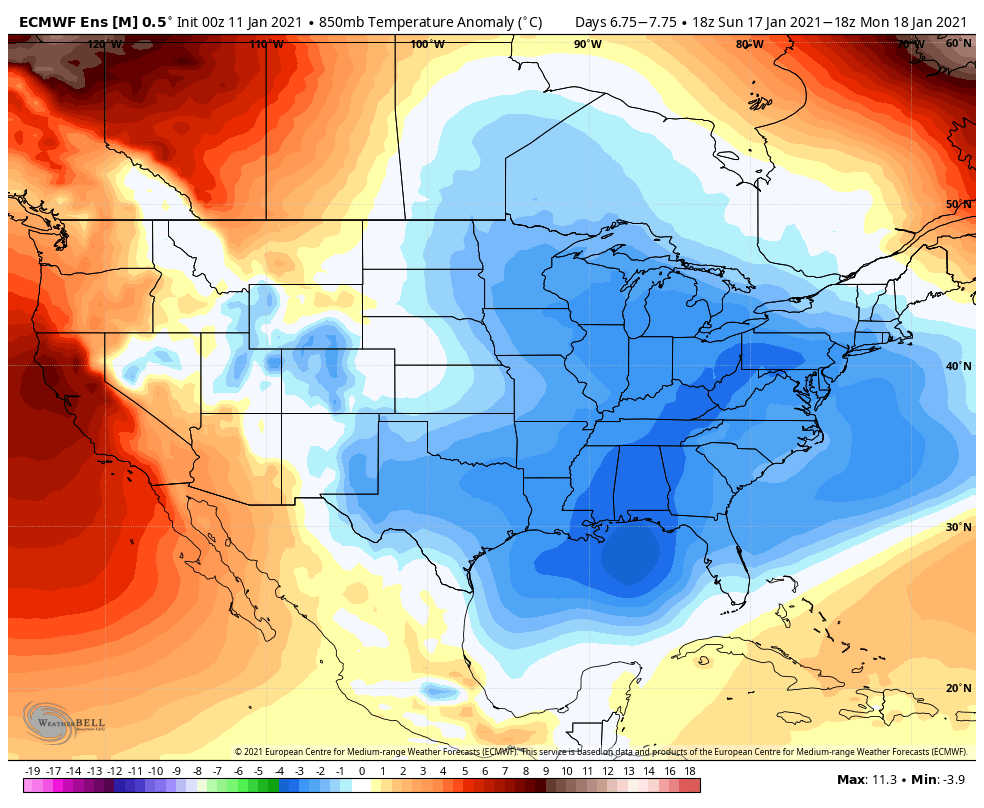
Beyond the front, we are cold for a couple days. This is not the polar vortex intrusion – just a colder batch of air. Expect the possible polar vortex intrusion to come closer to the end of next week, along with a few storm chances.