While the relatively boring weather pattern continues, the pockets of dry air moving in randomly have been playing quite the temperature roulette game. Fluctuations of 7-10 degrees in a matter of minutes have been seen, along with sun snow showers, and some incredible inversions. This is overall due to the lack of flow at certain levels and lack of forcing in this pattern. Microclimate factors tend to take over until the pattern reactivates itself. Expect this to continue through early next week.
It’s Friday so we’re looking into the long-term, though we’ve been touching on it for days since there hasn’t been much else to talk about beyond erratic temperature movements.
At this point, it doesn’t look likely that the 1/12-1/13 storm will be impactful to the Northeast due to the continued blocking, but may bring some light precipitation to the Mid-Atlantic.
The next point of interest comes in around 1/15, where we start flirting with the intrusion of some arctic air (it’s just the appetizer, it’s not the full polar vortex). We may see a low generate along the strong front, which could bring some precipitation to the east. This initial batch of cold looks to ease slightly over MLK weekend, with the stronger push likely coming after the holiday weekend.
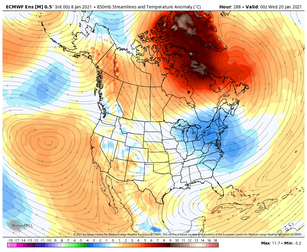
The European has been a lot less “bullish” with the arctic intrusion compared to the American and Canadian models. However, it still has significant cold projected as seen in the image.
Long-term projections hold the cold through at least 1/23-24.