
Not too much to update on today – the storm has departed and left a blanket of snow in its wake throughout Vermont, New Hampshire and Maine. Highest amounts were in the expected areas of northern VT, NH and into Maine. Up to 8″ have been reported.
We’ll have a quiet 24 hour period before the next system arrives Sunday evening and into the overnight hours. There’s a fair amount of variability of how this offshore low will interact with current energy, along with the depth of snowfall bands. However, it will keep temperatures at bay and allow for some prolonged cool air and cloud cover. The strong blocking prevents much movement of this low until late Wednesday or Thursday. There are some coastal systems that try to form but the blocking may be too strong.
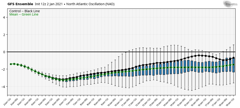
The relative consistency and deepening of the NAO this week shows that we’ll have a quiet pattern due to the trapped low. The ebbs and flows show that a tumultuous pattern should pick back up around the 9th and continue into the middle of the month.