We close out 2020 with temperatures on the move downward after some rain/snow showers came through earlier today. This front will sag to the south of the Mid-Atlantic as the next piece of energy gears up in the south. There’s a fair amount of energy with this system, producing a swath of severe weather in the Southeast tonight and tomorrow.
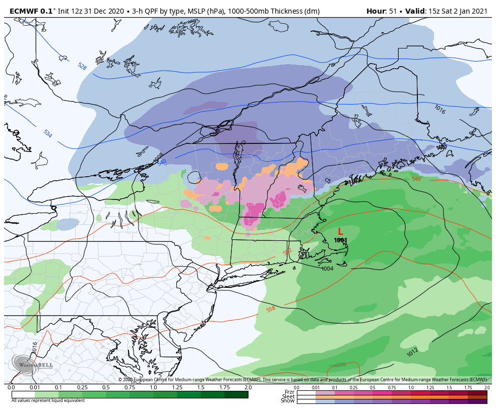
The storm system coming in Friday evening and Saturday is trending cooler for northern areas of New York, Vermont, New Hampshire and Maine. The low that is developing off the Gulf of Maine is wrapping cold air back in into the mid-levels throughout Saturday morning, which should prevent some of the change over and mix. However, some mixing and sleet will still likely come in, even for areas showing snow the majority of the time. The battle of cold versus warm will come somewhere, and it usually resolves around terrain.
This storm system provides a widespread 3-6″ across the areas staying all snow. central Vermont and New Hampshire will likely see 2-4″ followed by sleet, and farther south we’ll see 1-3″ of snow followed by sleet and freezing rain. The cold that comes in behind this system is brief. Saturday night is cool, but temperatures boost into the low to mid 30’s at base areas on Sunday ahead of the second system.
The coastal system may be much more significant, should the track continue in it’s current trajectory. We’ll continue to watch that closely.