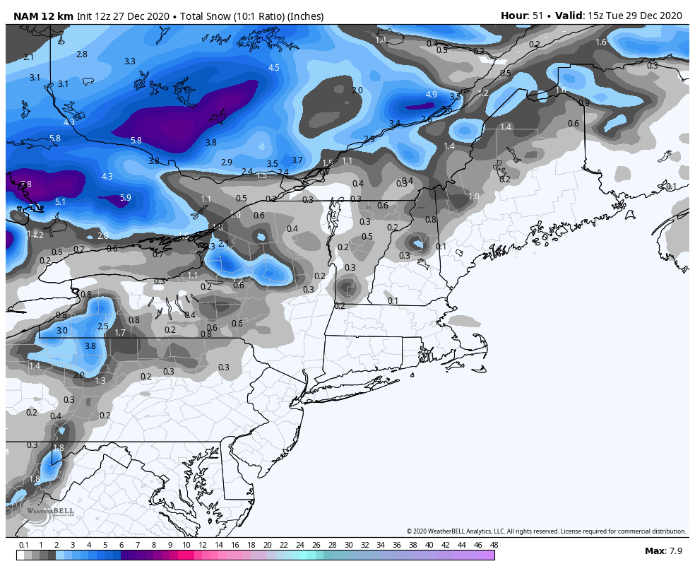
After a cool start, temperatures begin to moderate today ahead of a front coming through on Monday. Though not “warm”, it will be warmer than yesterday with more cloud cover as well. The front approaches Monday morning and is through the Northeast by Monday evening, along with some light snow and rain showers. Snow may accumulate on the favored upslope ridges Monday night into Tuesday morning.
Behind the front on Monday, we’ll have another deep, but brief batch of cold air to come Tuesday night into Wednesday. Similar to last week, that cold only holds for so long before we start to become influenced by the nexts system. Wednesday will be a transition day, with temperatures moderating slowly and clouds building in ahead of the New Years Eve/Day system.
There is still quite a bit of discrepancy on this system and it’s structure as it heads through the Great Lakes and New England. However, the good news is that it does not look to be a repeat of the Christmas Day storm, as the strong AO and less positive NAO may help keep this one at bay. Regardless, we do warm up and may see some rain showers with this overnight from New Years Eve to New Years Day.
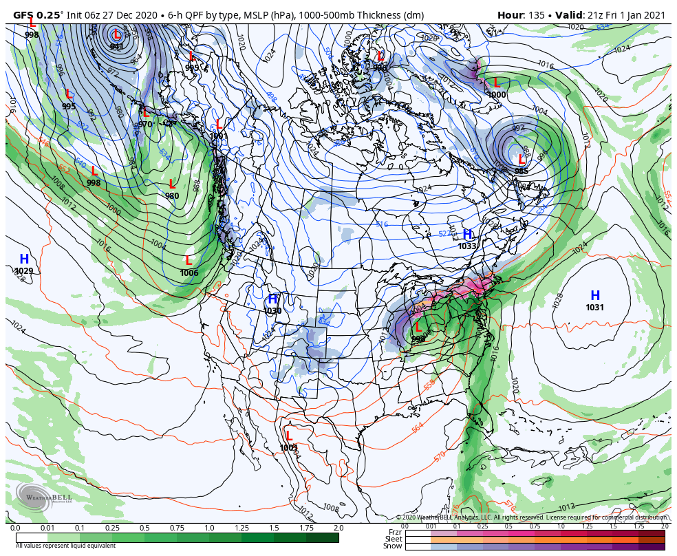
Behind this cold front, we really start to see some interesting movements in the pattern. Whereas models were bringing up another awful inside runner low, they’re now coming toward the solution of a cold air damming situation. This makes more sense with an increasingly negative NAO (which there is consensus on in the model data). This would be impactful through New Years weekend, and while we’re not seeing an onslaught of rain, icing does look possible along with some heavy, wet snow. Notice the high positions with this system – very different than the last one. We have a strong high in central Quebec, and a strong high over the Atlantic. This will squeeze the low in between the two, but the Quebec high is stronger (based on this model depiction), resulting in blocking and cold air damming. More details of course will come on that in the coming days. I still think we may have to wait through the first week or 10 days of January to see some bigger changes in the pattern.