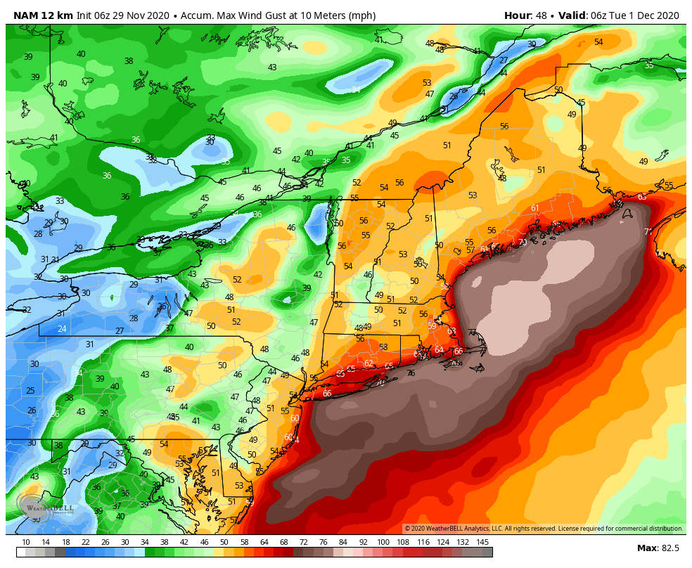
The warmth is returning today as our next system approaches with quite a bit of warm air. Rain will move in during the day Monday from southwest to northeast – with everyone seeing rain by sunset and high wind. Total rainfall will be between 1-2″ with this system. Wind will be gusty out of the SSE and we’ll have gusts over 80 mph possible at the higher summits, and 40-50 mph gusts at the bases. This will be mostly with the low pressure passage, which will be Monday evening – late Monday night. Downed trees and power issues are possible leading into Tuesday.
We’re not seeing much more agreement on the end-of-week pattern and how it will impact a potential weekend storm. As we’ve been talking about, cut-off lows can be very hard to “nail down” until we’re nearly into the situation itself. How it reengages back into the pattern is going to be the crucial factor for the storm 12/5-12/6. There are some scenarios of the storm staying offshore; while that bodes well for colder air, it would eliminate the chance for significant natural snow.
However, ensemble teleconnections of the Euro, Canadian and GFS point to a negative NAO (blocking pattern), negative AO (cold air available) and positive PNA (eastern trough) around 12/4. While the negatives are just slightly negative, it’s the best scenario we’ve seen with these three working together in a long time – it happened briefly after closures in 2020 but was fairly commonplace in Winter 2018-2019. This would indicate we’re in line with a more exciting system for next weekend. While deterministic models show fairly benign (or awfully rainy) scenarios currently, the ensembles are better to look at for unpredictable patterns like cut-off lows.