The deep cold continues to settle in Monday night. There will be some ebbs and flows to the cold this week, especially as we get into the Mid-Atlantic, but windows will be plentiful for snowmaking for all.
Our only significant warm-up comes on Wednesday as a warm front crosses the region. A low pressure system will quickly develop along the cold front bringing some measurable snow to the area Wednesday into Wednesday evening, though temperatures will be on the increase. This may mix with sleet and even rain in the Berkshires, Catskills, and farther south.
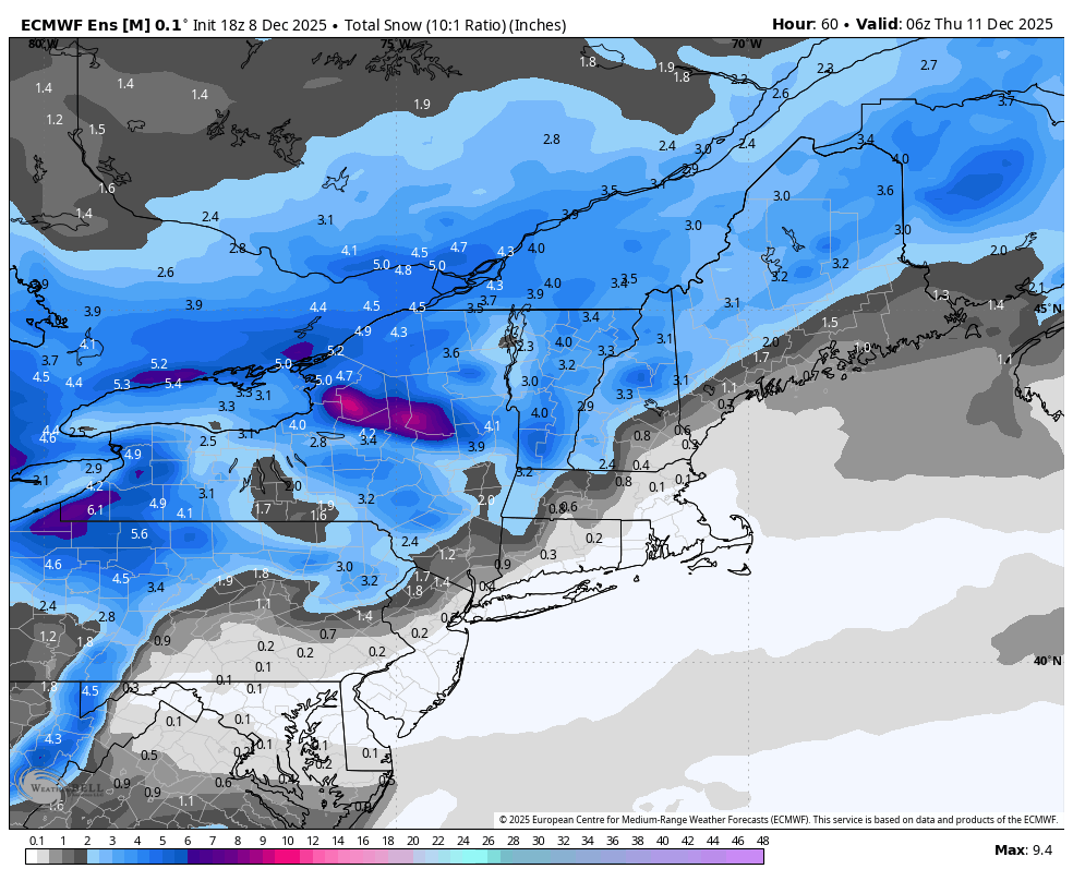
I’ve posted the Euro ensemble snowfall — this is a 10:1 ratio, therefore we may see slightly higher amounts. A general 3-5″ is what I’m expecting across all areas not mixing.
Another wave of cold does come in on Thursday, deepening through the end of the week, and staying cool for the weekend/early next week.
Aside from the snow on Wednesday there’s not much precipitation to report. The deep cold keeps a lot of the activity at bay.