
We’re getting down to the nitty gritty time frame of 20 days before Christmas — and about 15 days before Christmas break begins for many. With Christmas/New Years on a Thursday this year, many kids have two solid weeks of school off. Or perhaps that’s just our district, but it’s a lot of time off!
Alright, let’s get to the details.
Days 7 -14
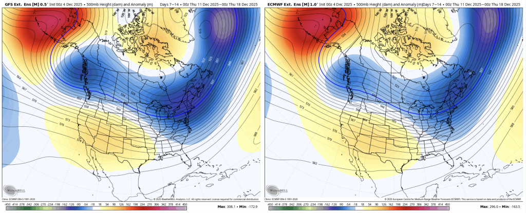
There’s remarkable consistency between the GFS (left) and Euro. The eastern trough continues which means cold rules the pattern. We are still in a La Niña, though weakening – as we talked about in Monday’s long term – so it’s possible that we still see a mixed precip event when low pressures form. We certainly lucked out with the track of Tuesday’s system, which produced great “base-making” snow for many areas. The take home message is — it’ll be cold more often than it’s not, but I don’t see a lot of precipitation chances given the depth and strength of the arctic high.
Days 14-21
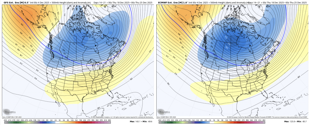
This really doesn’t give you a lot from the image – looks very zonal (east/west) so I’m adding in the temperature anomaly too.
Cold air intrusion is centered in west-central Canada, which is ushering in colder air to the northern tier of the country. It’s not making it to the east coast in full force, but there’s nothing forcing it out either. This isn’t a terrible setup for storms, but we have to hope our ENSO phase goes from La Niña into neutral territory at this time so we have a better chance of the cold dome hanging on.
I will note that the Euro is slightly stronger than the GFS with this, which is not the Euro’s typical movement. Also, in looking at the Euro Ensemble 7 day snowfall totals, I’m noticing a bump upwards around Christmas.
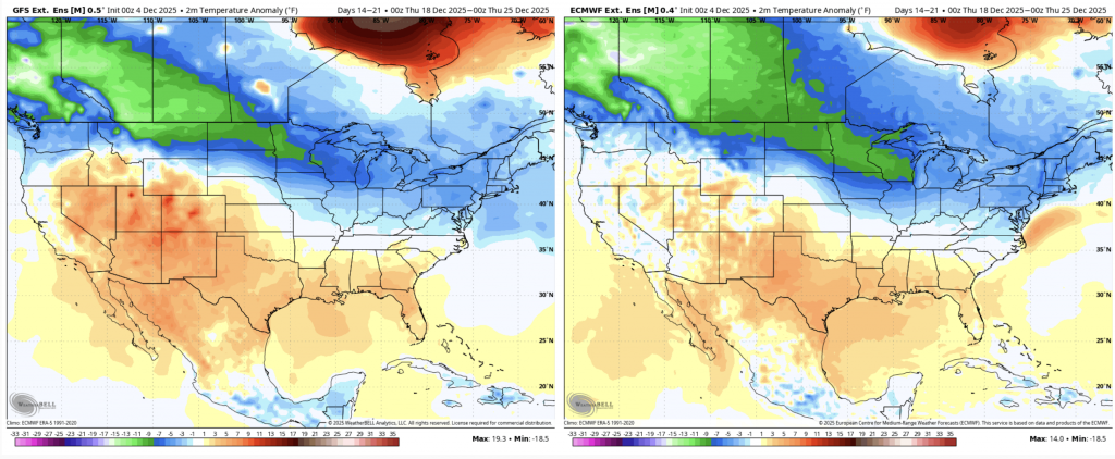
Still plenty of time to go, but right now I don’t see anything terribly ominous for the holiday week(s) at the moment. These are all 7-day averages/anomalies, so that doesn’t mean we don’t have a warmer day here or there, but all in all, it’s looking promising.