With the holiday and some travel, we’re going to put it all in one today.
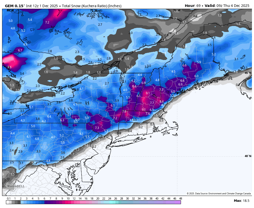
We are starting off the week with the first widespread snowfall of the season. It looks like the jackpot is going to be in southern Vermont and New Hampshire. It may also clip the Berkshires and northern Catskills. Right now highest amounts are set at 5-8″, but there could be some higher amounts at summit levels.
I like the Canadian output for this particular storm, as I do with many winter events (it’s underrated). The Euro has been a bit timid, and I think the GFS/NAM are overdone. I’m a little conservative, but that’s how I usually roll.
Behind the storm system, there’s not a high amount of wind, therefore snow should settle in place. The quality of the snow is also not terribly dry — good early season snow from Maine to the PA/MD border.
We are fairly quiet on Wednesday with some pockets of sunshine. On Thursday, an arctic front will come through bringing the coldest temperatures of the season. Snow showers/squalls may accompany this front, with a small chance of lightning. Many high elevation summit levels will drop below zero Thursday night and stay in the single digits Friday.
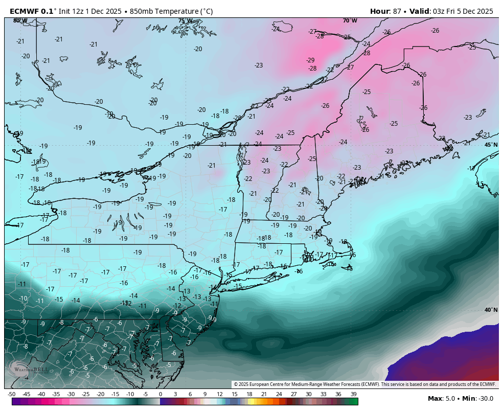
This cold blast is quite impressive for early December with -25C 850mb temperatures throughout New England. The Euro shows these temps at 10pm on Friday.
We have another storm system to watch for the weekend. Models have been going back-and-forth on creating the coastal low, which looks similar to Tuesday storm, or pushing it too far offshore/not phasing the energies. Models notoriously can’t handle too many things at once, therefore we should get a better picture by Wednesday/Thursday.
Overall, it looks quite cold and we’ll have almost continuous snowmaking opportunities in New England, and only some daytime breaks for the mid Atlantic.
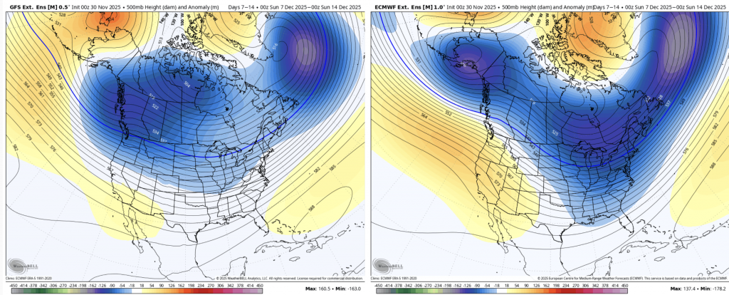
Moving into the long range, the cold sticks with us solidly through the middle of the month with good consensus of the GFS (left) and Euro. Days 7-14 show the deep trough across the north and east, therefore we’ll continue to see cold air availability. This particular set up may make it hard to get natural snow as often times it gets shunted to the south or offshore. Snowmaking opportunities should remain plentiful.
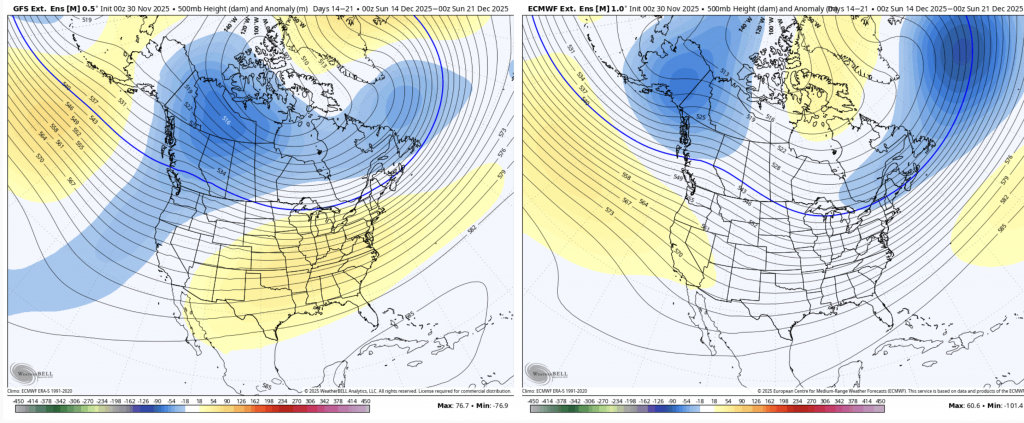
For Days 14-21, we start to see a shift and disagreement in the models. The GFS creates a warmer pattern, but the euro keep keeps it more neutral. The trough over Southeast Alaska in the Euro usually signifies a ridge in the center of the country, which could still keep us in a cold yet stormy pattern, as we see the troughiness hang on into New England.
While I try not to go beyond three weeks as there is so much uncertainty and potential movement in the models, it is obviously a very important timeframe for us.
Right now, it looks like we would enter into a more mild time period for Christmas week. Given the amount of cold we’re going to see in the next two weeks, mild is subjective and has quite a range.
Behind every deep cool down comes a time to let the atmosphere recharge, and I believe we may see that in the holiday week.
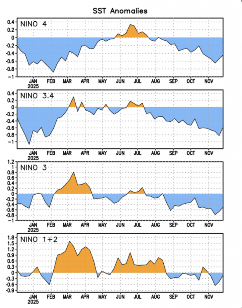
La Niña also seems to be reverting, as we expected the strongest point of it to be in the late fall.
We can see the jump up in all regions within the past two weeks.
With sea surface temperatures rising over the next couple weeks, this adds another volatile factor to the long term, which makes me less confident on what the models are portraying at the moment.