We’re looking at a break in the cold for a couple days once it retreats Monday night. Most of Tuesday and Wednesday are relatively warm (though with the dampness it won’t really feel warm).
We’ll have two rounds of precipitation, mostly rain to come through. One is with the warm front Tuesday night/Wednesday morning and the second is with the cold front late Wednesday/Thanksgiving. There could be some drizzle in between the two areas of precipitation.
The strong cold front comes through on Thanksgiving from west to east. Total precipitation should stay under .50″ before the upslope snows start. Depending on location, it may take the entire day for the cold to settle, but by the evening, most areas will be seeing snowmaking windows. Favored upslope snow areas will see continual snow showers through the weekend.
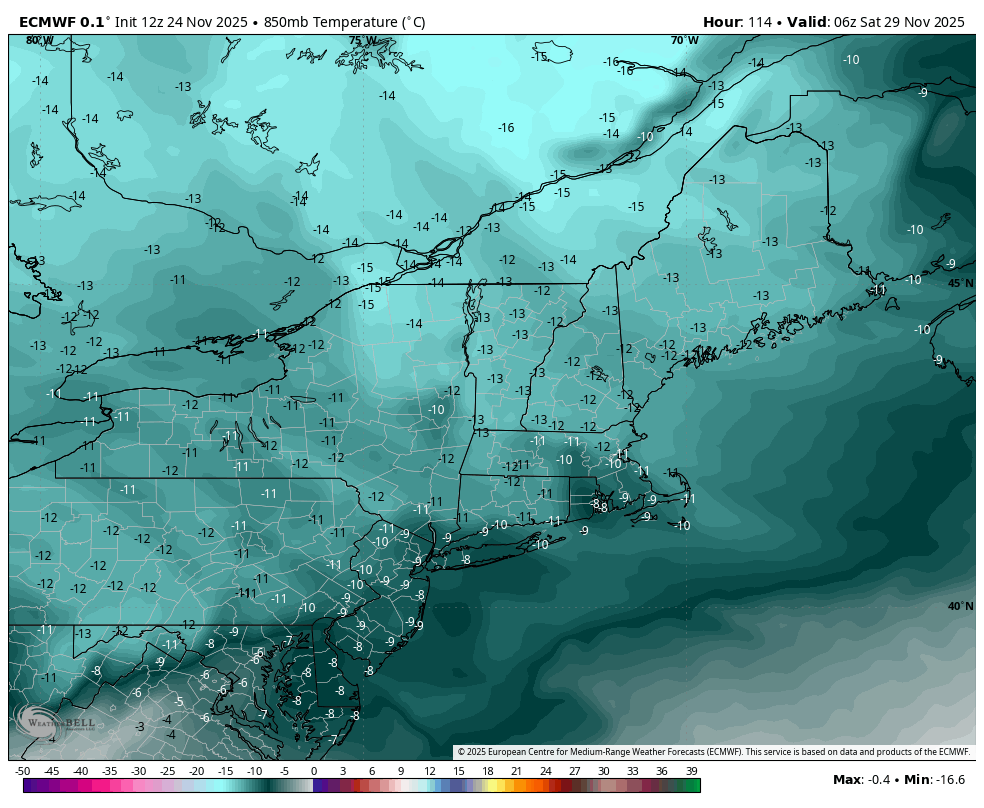
It really takes until Friday night/early Saturday morning for the core of the cold to come in. We see 850mb temps getting well below -10C all the way into PA (image from the Euro, 1am Saturday morning). This will be the first opportunity for some areas in the Mid-Atlantic to get the guns on.
We’ll lose the cold on Sunday, from southwest to northeast as the next system arrives for Sunday night and Monday. Right now this looks to be a mostly wet storm, and there’s no blocking to keep the cold in.