The forecast was favorable through much of the week for snowmaking, and while we have a little break today (Friday), we’ll see windows come back off/on through Tuesday, depending on location. The next round of cold isn’t particularly deep, therefore the Catskills & south may miss out on windows (outside of Sunday night) until after Thanksgiving.
But onto the long range — it’s looking pretty good. Also looking fairly active, but we also have an increasingly positive NAO until around Dec 5-7. What that means is that the active pattern may not include widespread snowfall — at first — but it could change. The NAO isn’t fully into its rhythm just yet, as we usually need the Atlantic to cool a bit more. It’s a good proxy nonetheless.
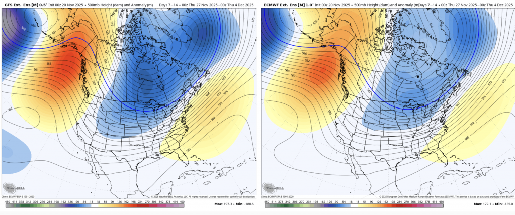
The Day 7-14 500mb anomaly (GFS left/Euro right) shows the center of trough-ing more so in the upper Midwest, therefore storms may take more of an “inside runner” path. This is common in La Niña situations, which the equatorial Pacific has hit momentarily. It’s weak and fleeting, but it’s there. Therefore we should have cold air available, but it’s the typical “when the storm comes, the cold retreats” situation — ie, no blocking (negative NAO).
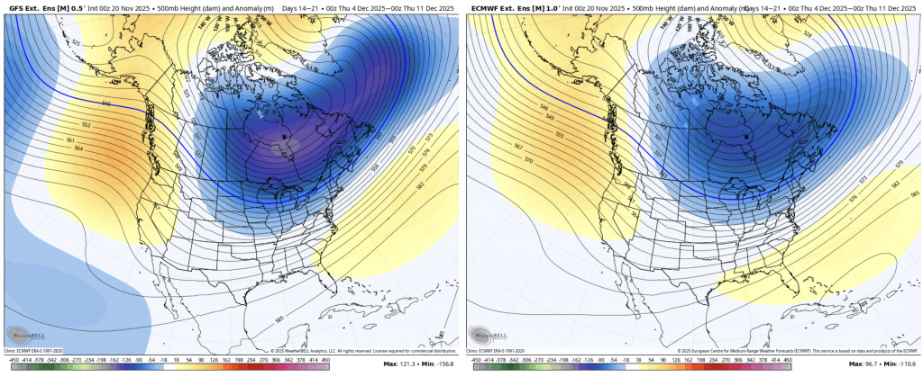
The center of the trough-ing moves east in Days 14-21 (Dec 4-11), which I think puts us in a much better position for our first widespread natural snows of the season. La Niña’s are not known for coastal systems, but this track is favorable for at least some clippers or progressive lows to get moving.
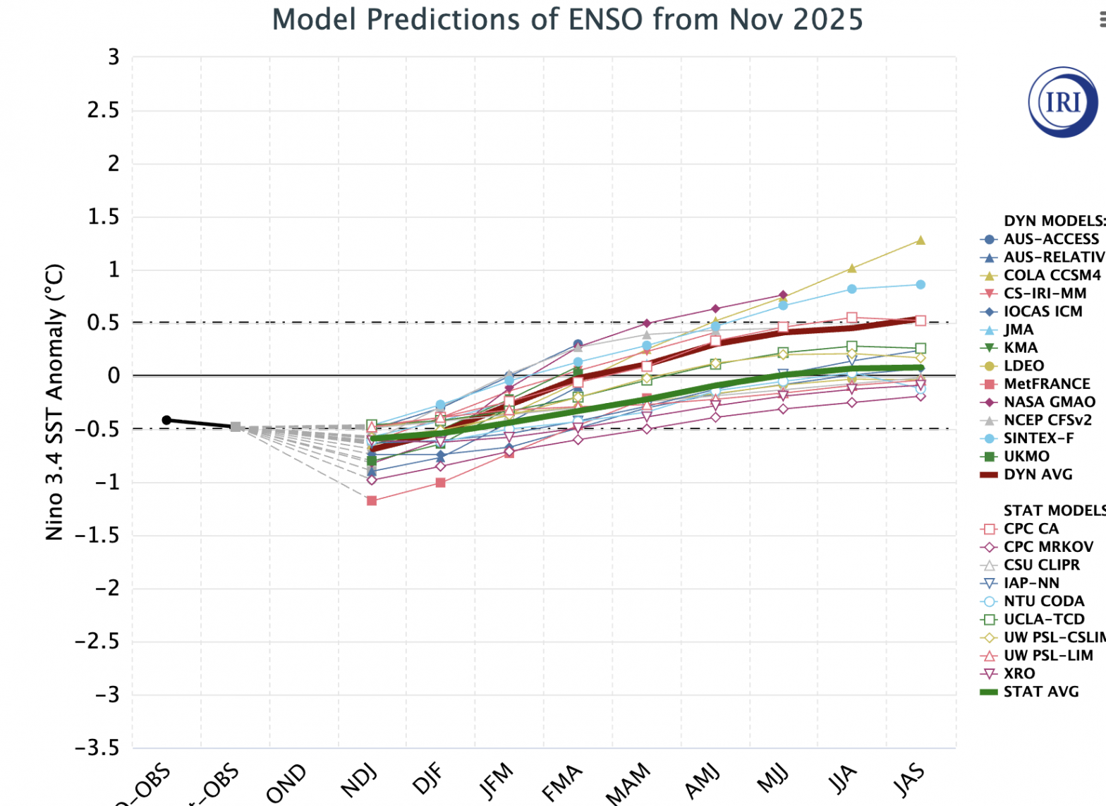
It is worth noting that the La Niña space we’re in currently will rapidly change. Below is the latest output from the International Research Institute at Columbia University. I find the dynamic average is the one to watch as the statistical average is skewed by the fact that there’s inherently more La Niña years than El Niño.

The line moves quickly — from NDJ to FMA we’re going up more than 0.5 for sea surface temperature anomalies. Since these are three month averages, the day to day is going to be a bit more significant. Therefore the second half of winter is going to vastly different than the first half — and my hunch is it’s different in a good way. Time will tell!
Notice the movement to weak El Niño for early fall. If that holds to early winter — whew! That would be fun – weak El Niño is the sweet spot for just enough cold to keep coastal systems snow in the Mid-Atlantic & New England.
Next week’s long term blog may be delayed into the weekend as I travel for the Thanksgiving holiday. There will be no change in forecast timing. Please feel free to reach out if you need anything!