The cold has settled in and we have some changes in the forecast — more so for the weekend ahead but changes nonetheless.
First, I wanted to make note on the timing of cold pushes/frontal passages. Each year models have updates with new algorithms and variable weights, to which meteorologists have to adjust to on the fly. Typically the first cold push sheds some light on these new biases. The first round of cold for high elevations in the first week of November was overdone by models, and cold took much longer to settle in. Therefore in adjusting for the first widespread cold last Monday, and another yesterday (Sunday), I slowed down the cold intrusion, especially since they were during the day (which can be counteracted by daylight, which is what happened early in the month), yet the cold was on time or slightly faster than expected.
Now that we’re in more of a cycle/pattern with the cold pushes, there’s a better idea of how the cold air masses will settle. I wanted to touch on the methodology of the forecast, as there were some discrepancies in the timing of cold that I’ve noticed.
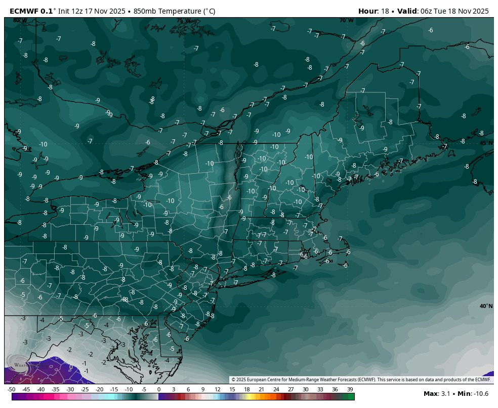
For the week ahead, we have quite a bit of cold air settled in, especially for Monday and Tuesday. Wind is whipping for Monday and will remain elevated through Tuesday. The core of the cold was in this morning, but there’s not much change in the air mass until Wednesday. We see the 850mb temperatures at 1am Tuesday in the image – many areas in the -10C range, per the Euro model. Upslope snow showers are dumping snow in the favored slopes of Vermont/NY, with another 6-12″ expected in the NEK & northern Greens & Adirondacks. Outside of those areas, snow showers continue throughout much of New England today but should taper off by Tuesday morning.
Moderation begins later Wednesday, but the cold will be stubborn to leave. There’s a weak wave moving through PA/VA Wednesday morning with some light rain and even snow to begin in northern PA.
Once this passes, we’ll see clear skies outside of the northern tier of NY/VT/NH/ME, which will bring some fruitful inversions to work from in the midweek.
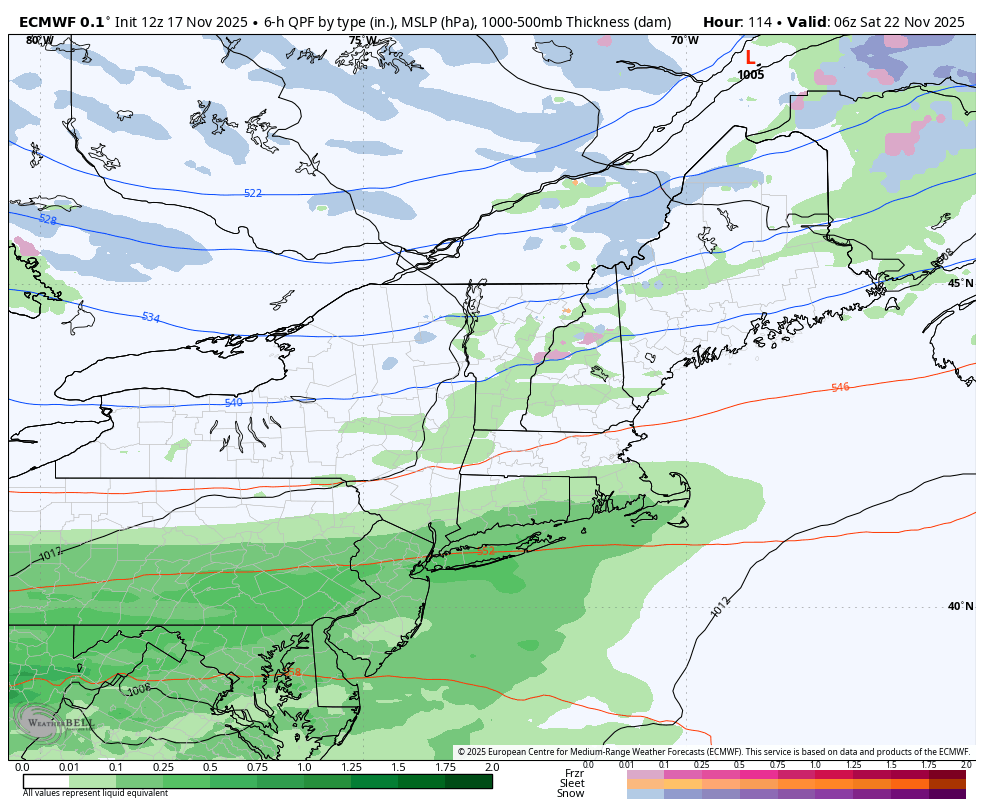
The big change in the forecast is that the system for Friday is more progressive as the timing is not working out for a low to develop along the front. The cold push is stronger, therefore the front is coming quicker, and moving the northern wave through faster. There’s no time for the low in Quebec to merge with the wave coming through the Mid-Atlantic. Therefore less rain is expected Friday, and cold returns heading into the weekend.
In terms of Thanksgiving week, there has been a lot of volatility in the long range. The Euro trended warm up until the last 24-36 hours. The GFS has flip flopped between colder and warmer solutions but never as warm as the Euro, and the Canadian has hedged a bit more toward a stable cold.
If last year is any indication, since we are following so closely to last November, we may have a brief break in snowmaking opportunities for midweek, thought not warm — with a stronger system arriving near or just after the holiday itself.
It may not happen on the exact day (which was Thanksgiving last year), but the atmosphere is acting similarly and something may fire up within a couple days of the holiday. We’ll save digging into that a bit more for our long range look at the end of the week.
Please feel free to reach out if you have any questions or would like to discuss anything further.