Starting to look a bit more in the long range…we have some ebbs and flows in the cold.
It’s very similar to what we had last November, after this nice stretch of snowmaking into the middle of next week, we’re going to start moderating the pattern for about 7 days.

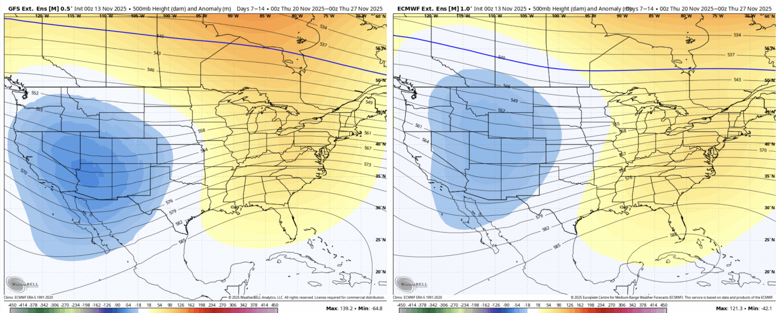
There’s fairly good consensus on this, as we’ve been talking about in the forecast discussions. Both the GFS and Euro Ensembles have the eastern ridge and western trough heading into 11/20-11/27. This doesn’t mean that we’re blowtorched, but windows will be limited to the higher elevations and short. Rain events are also possible.
Moving into the holiday and week and beyond, the pattern begins changing. The models have been showing a decent cold shot coming right on Thanksgiving, but it’s not consistent.
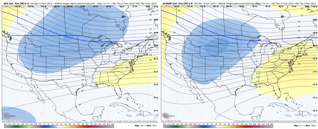
This particular pattern looks fairly good for storm development and perhaps some coastal systems, especially the GFS (left). While we’re not in the incredibly cold pattern at this point, we’re back to waves of cold 11/27-12/4. By the first full week of December, we should be seeing the colder air masses settle in more consistently.